MyTopo
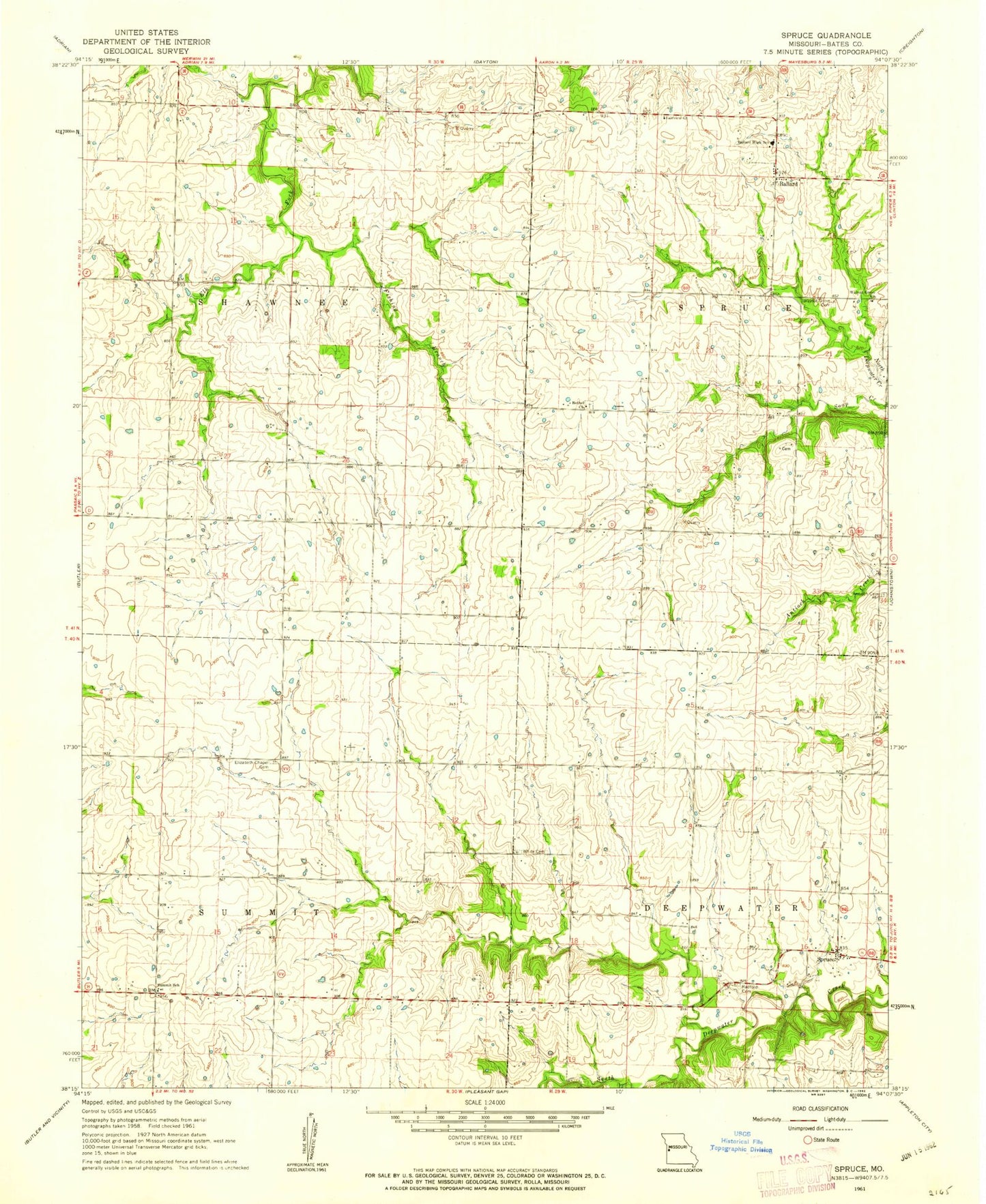
Classic USGS Spruce Missouri 7.5'x7.5' Topo Map
Couldn't load pickup availability
Historical USGS topographic quad map of Spruce in the state of Missouri. Map scale may vary for some years, but is generally around 1:24,000. Print size is approximately 24" x 27"
This quadrangle is in the following counties: Bates.
The map contains contour lines, roads, rivers, towns, and lakes. Printed on high-quality waterproof paper with UV fade-resistant inks, and shipped rolled.
Contains the following named places: Antioch Cemetery, Ballard, Ballard Elementary School, Ballard High School, Bethel Church, Cherry Grove School, Culver, Elizabeth Chapel Cemetery, Fairview Church, Fishing Branch, Griggs School, Harmony School, Olive School, Radford Cemetery, Redmond School, Spruce, Straight Branch, Summit School, Township of Deepwater, Township of Shawnee, Township of Spruce, Township of Summit, Valley School, Walnut Grove Cemetery, Walnut Grove Church, White Cemetery