MyTopo
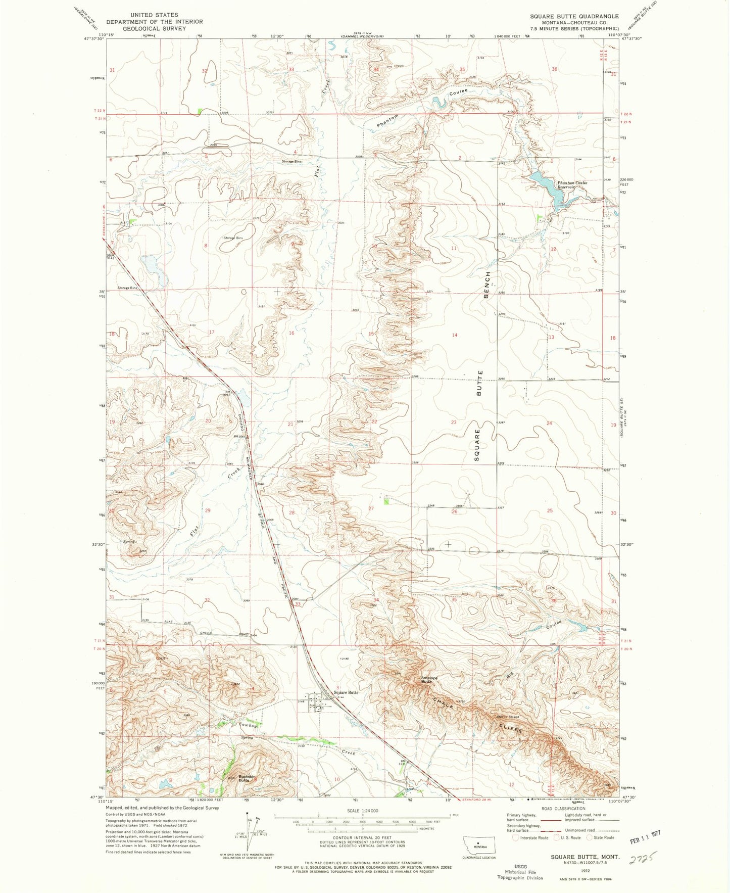
Classic USGS Square Butte Montana 7.5'x7.5' Topo Map
Couldn't load pickup availability
Historical USGS topographic quad map of Square Butte in the state of Montana. Map scale may vary for some years, but is generally around 1:24,000. Print size is approximately 24" x 27"
This quadrangle is in the following counties: Chouteau.
The map contains contour lines, roads, rivers, towns, and lakes. Printed on high-quality waterproof paper with UV fade-resistant inks, and shipped rolled.
Contains the following named places: 09N12E23DCBA01 Well, 21N12E15BDB_01 Well, 21N12E28CDA_01 Well, 21N13E07BBBC01 Well, 22N12E32DCD_01 Well, 59446, Antelope Butte, Buckskin Butte, Chalk Cliffs, Panton Coulee, Panton Coulee Reservoir, Phantom Coulee Reservoir Dam, Square Butte, Square Butte Census Designated Place, Square Butte Post Office, Square Butte School