MyTopo
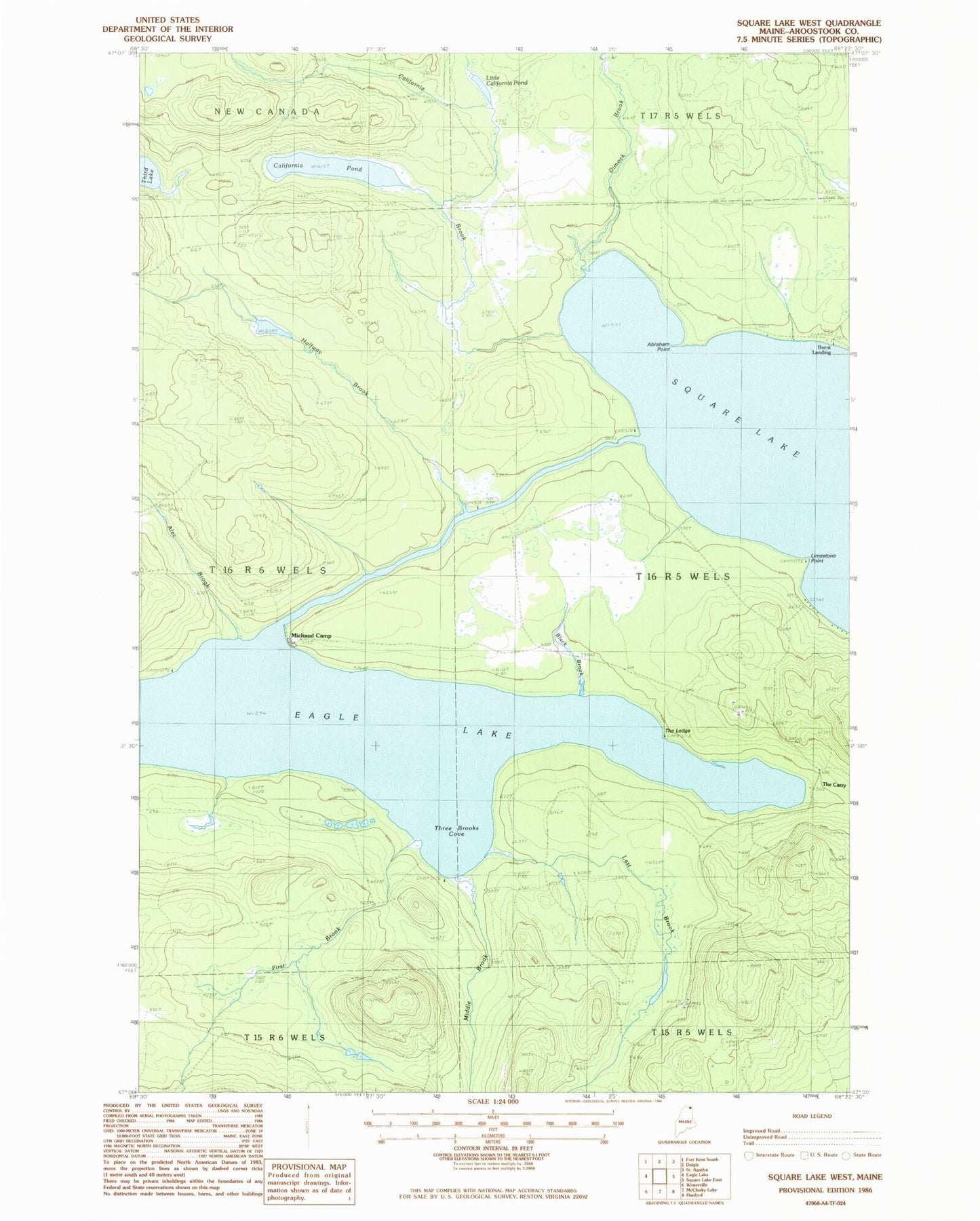
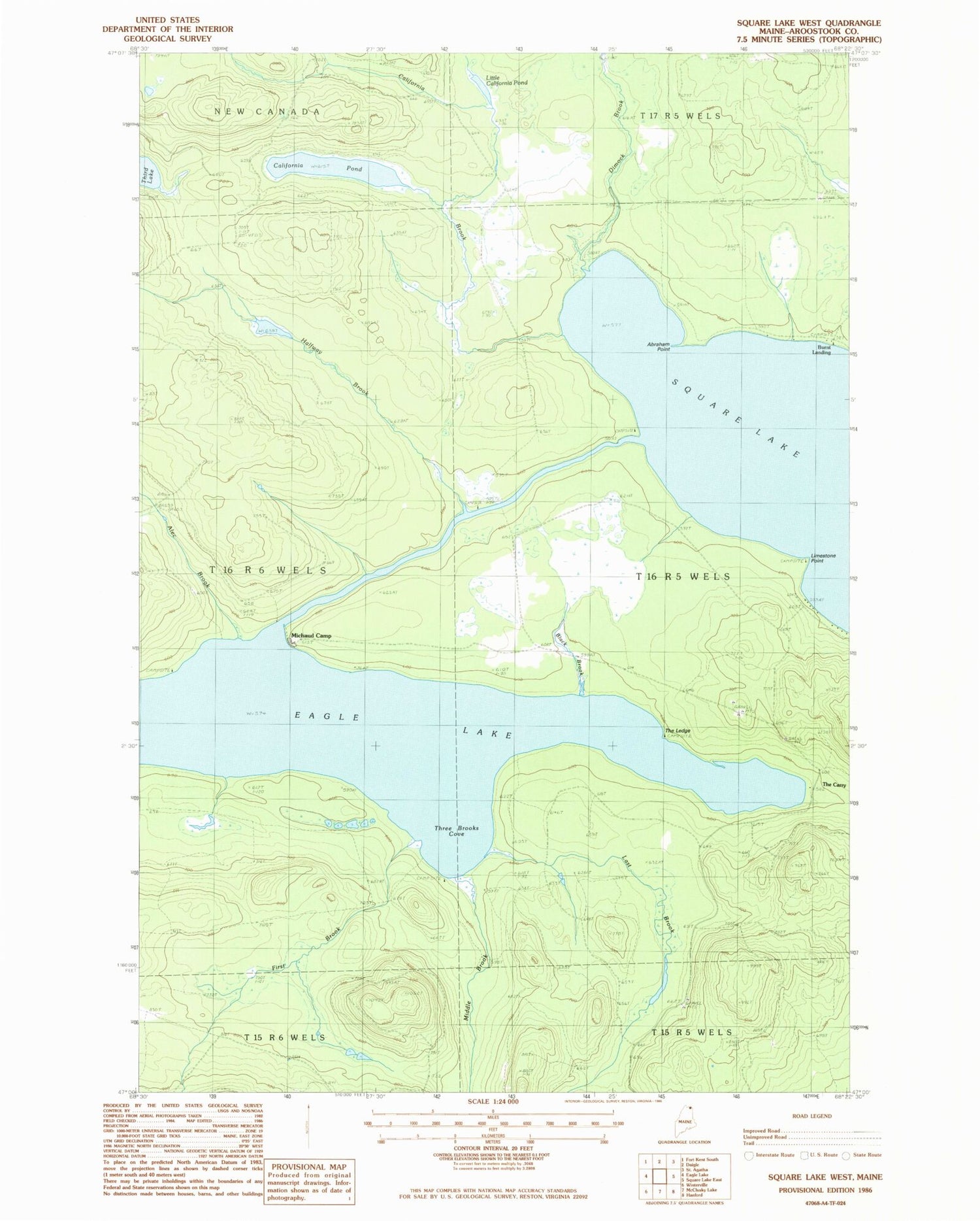
Classic USGS Square Lake West Maine 7.5'x7.5' Topo Map
Regular price
$16.95
Regular price
Sale price
$16.95
Unit price
per
Couldn't load pickup availability
Historical USGS topographic quad map of Square Lake West in the state of Maine. Typical map scale is 1:24,000, but may vary for certain years, if available. Print size: 24" x 27"
This quadrangle is in the following counties: Aroostook.
The map contains contour lines, roads, rivers, towns, and lakes. Printed on high-quality waterproof paper with UV fade-resistant inks, and shipped rolled.
Contains the following named places: Abraham Point, Alec Brook, Black Brook, California Brook, California Pond, Dimock Brook, Eagle Lake, First Brook, Halfway Brook, Last Brook, Limestone Point, Little California Pond, Michaud Camp, Middle Brook, The Ledge, Three Brooks Cove