MyTopo
Classic USGS Squaretop Butte North Dakota 7.5'x7.5' Topo Map
Regular price
$16.95
Regular price
Sale price
$16.95
Unit price
per
Couldn't load pickup availability
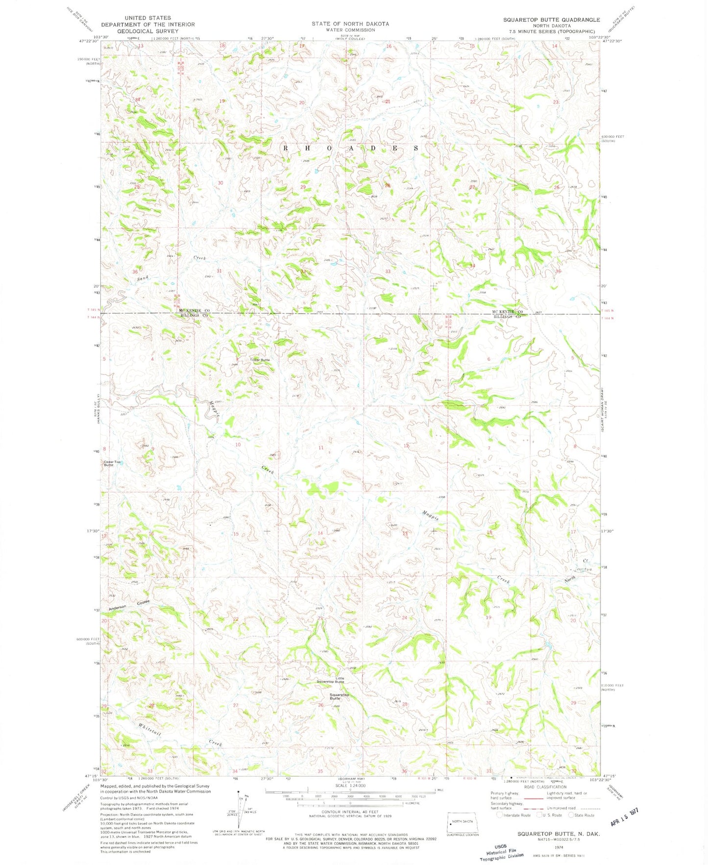
Historical USGS topographic quad map of Squaretop Butte in the state of North Dakota. Typical map scale is 1:24,000, but may vary for certain years, if available. Print size: 24" x 27"
This quadrangle is in the following counties: Billings, McKenzie.
The map contains contour lines, roads, rivers, towns, and lakes. Printed on high-quality waterproof paper with UV fade-resistant inks, and shipped rolled.
Contains the following named places: Anderson Coulee Oil Field, Magpie Oil Field, Little Squaretop Butte, North Creek, Squaretop Butte, Tower Butte, Big Top Mesa, Ice Caves Point of Interest, Big Top Research Natural Area, Two Top Research Natural Area, Castel Rock, Northrup Ranch, O'Brien Ranch