MyTopo
Classic USGS Squaw Lakes Oregon 7.5'x7.5' Topo Map
Couldn't load pickup availability
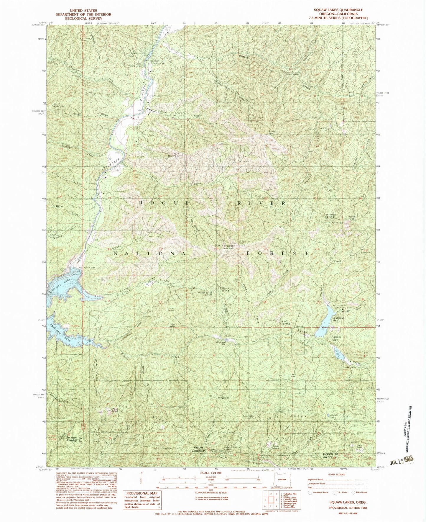
Historical USGS topographic quad map of Squaw Lakes in the states of Oregon, California. Typical map scale is 1:24,000, but may vary for certain years, if available. Print size: 24" x 27"
This quadrangle is in the following counties: Jackson, Siskiyou.
The map contains contour lines, roads, rivers, towns, and lakes. Printed on high-quality waterproof paper with UV fade-resistant inks, and shipped rolled.
Contains the following named places: Mud Spring, Mulligan Bay, Mulligan Bay Campground (historical), Mingo Gap, Hanley Gap, Buck Gulch, Jackson Recreation Site, Placer Recreation Site, Flumet Flat Recreation Site, Ash Flat, Armstrong Gulch, Baldy Peak, Beaver Creek, Beaver Sulphur Recreation Site, Billys Gulch, Brushy Gulch, Carlton Pasture, Charlie Buck Gulch, Collings Gulch, Curiosity Spring, Daffodil Mine, Dividend Bar, Doe Hollow, French Gulch, French Gulch Divide, Hanley Gulch, Hole in the Ground, Iron Hand, Iron Knob, Kanaka Gulch, Kilgore Gulch, Kilgore Spring, Kinney Creek, Little Grayback Mountain, Lyman Creek, Mule Creek, Mule Mountain, Mulligan Gulch, Oak Flats, Palmer Creek, Placer Mine, Rock Gulch, Slickear Creek, Sourdough Gulch, Squaw Creek, Squaw Lakes, Squaw Peak, Stein Butte, Stringtown Gulch, Summit Lake, Texter Gulch, Water Gulch, Wright (historical), Spring Gulch, Applegate Dam, Squaw Lakes Dam, Tipsu Tyee Recreation Site, Harr Point Recreation Site, Latgawa Cove Recreation Site, Wright Post Office (historical), French Gulch Recreation Site, Stringtown Recreation Site, Squaw Lakes Recreation Site, Swayne Viewpoint, Flume Gulch, Calsh Trail, United States Forest Service French Gulch Boat Ramp, Daffodil Mine, Mallard Gulch