MyTopo
Classic USGS Squaxin Island Washington 7.5'x7.5' Topo Map
Couldn't load pickup availability
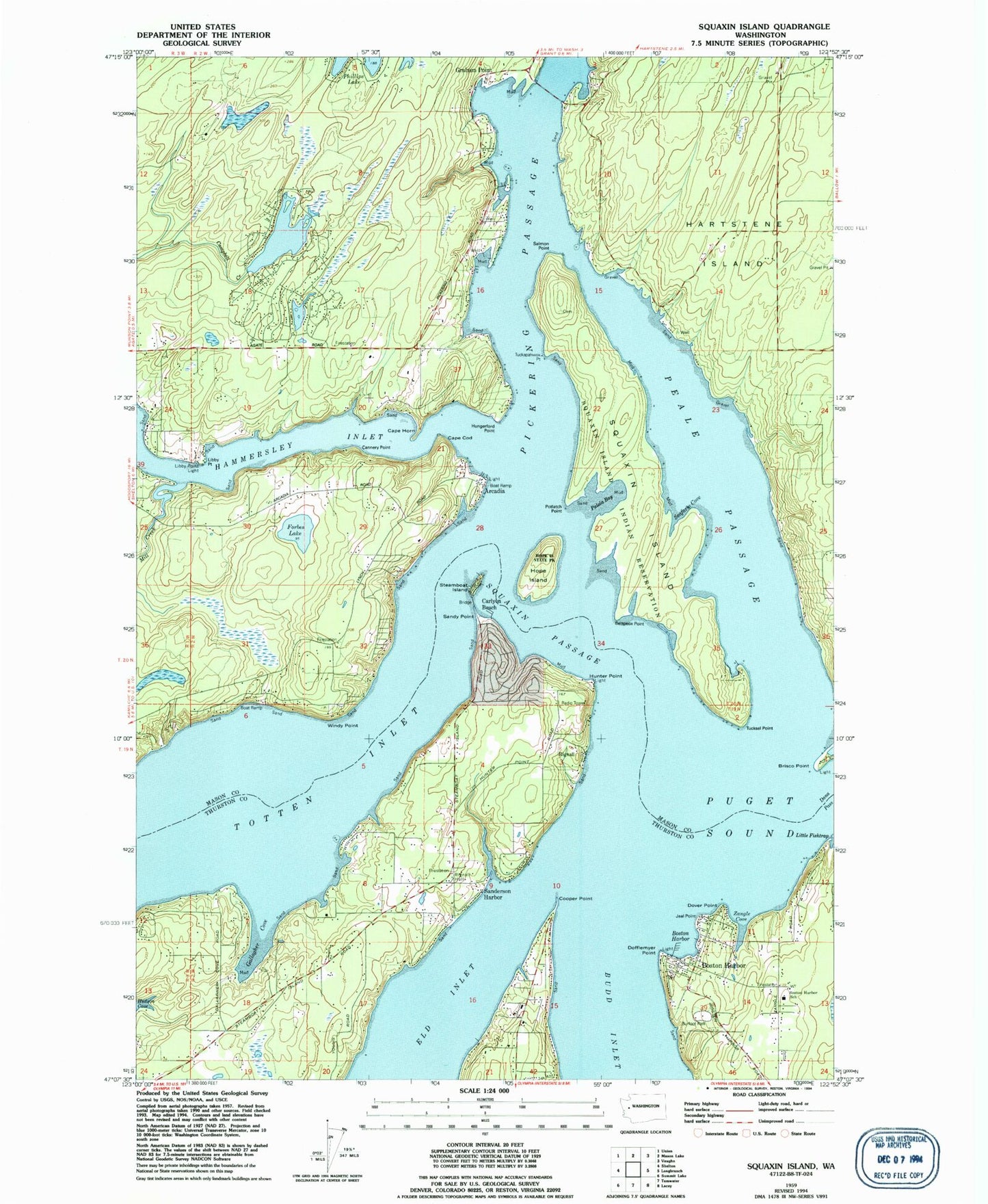
Historical USGS topographic quad map of Squaxin Island in the state of Washington. Typical map scale is 1:24,000, but may vary for certain years, if available. Print size: 24" x 27"
This quadrangle is in the following counties: Mason, Thurston.
The map contains contour lines, roads, rivers, towns, and lakes. Printed on high-quality waterproof paper with UV fade-resistant inks, and shipped rolled.
Contains the following named places: Brisco Point, Cape Cod, Cape Horn, Cooper Point, Dover Point, Forbes Lake, Gallagher Cove, Hope Island, Libby Point Light, Peale Passage, Rignall Hall, Salmon Point, Sanderson Harbor, Sandy Point, Squaxin Island, Squaxin Island Reservation, Squaxin Passage, Steamboat Island, Windy Point, Zangle Cove, Belspeox Point, Seafarm Cove, Tuckapahwox Point, Little Fishtrap, Tucksel Point, Harstine Island, Arcadia, Graham Point, Squaxin Island State Park (historical), Big Twin Lake, Edgewater Beach, Boston Harbor, Arcadia Point, Dofflemyer Point Lighthouse, Totten Inlet, Boston Harbor Elementary School, Carlyon Beach, Rignall, Jeal Point, Boston Harbor, Libby Point, Potlatch Point, Hungerford Point, Timberlakes Dam, Littletwin Lakes Dam, Little Twin Lake, Dofflemyer Point, Hunter Point, Mill Creek, Palela Bay, Carlyon Beach Sewage Treatment Plant, Timber Lake-Harstine Island Division, Thurston County Fire District 13 Griffin Fire Department Station 13 - 2, Mason County Fire District 5 Station 5 Agate, Mason County Fire District 4 Station 43, Cannery Point