MyTopo
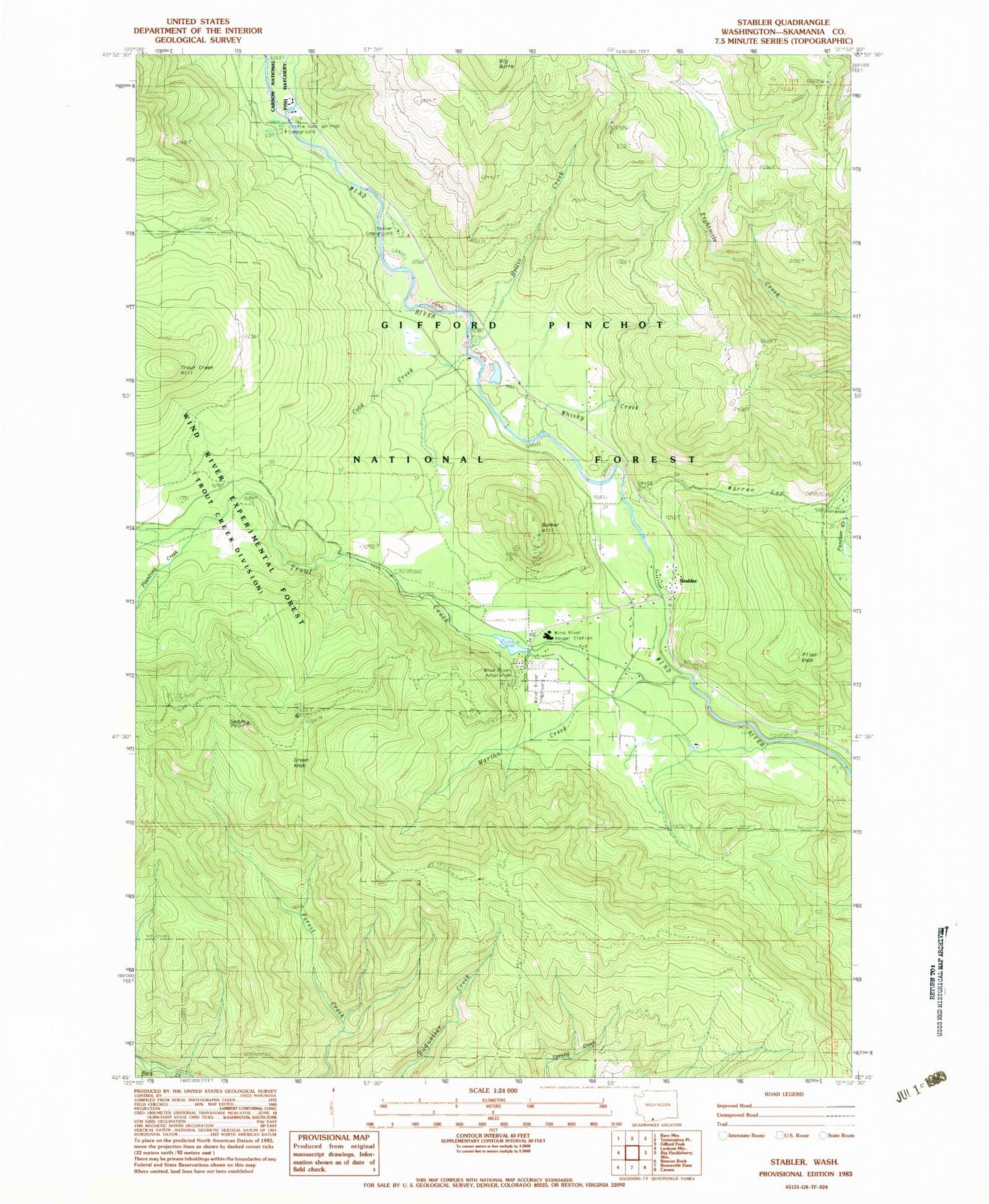
Classic USGS Stabler Washington 7.5'x7.5' Topo Map
Couldn't load pickup availability
Historical USGS topographic quad map of Stabler in the state of Washington. Typical map scale is 1:24,000, but may vary for certain years, if available. Print size: 24" x 27"
This quadrangle is in the following counties: Skamania.
The map contains contour lines, roads, rivers, towns, and lakes. Printed on high-quality waterproof paper with UV fade-resistant inks, and shipped rolled.
Contains the following named places: Bunker Hill, Cold Creek, Green Knob, Hemlock Ranger Station, Hollis Creek, Little Soda Springs Campground, Martha Creek, Pilot Knob, Planting Creek, Rock Creek Trail, Sedum Point, Stabler, Stevenson Ridge Trail, Trout Creek, Trout Creek Forest Camp, Trout Creek Hill, Warren Gap, Whisky Creek, Wind River Experimental Forest, Wind River Natural Area, Beaver Campground, Wind River Nursery, Wind River Ranger Station, Carson National Fish Hatchery, Trout Creek Picnic Area, Panther Creek Campground, Wind River Arboretum, Bunker Hill Lookout, Hemlock Dam (historical), Trout Creek Pond (historical), Skamania County Fire District 1 Station 3 - Trout Creek