MyTopo
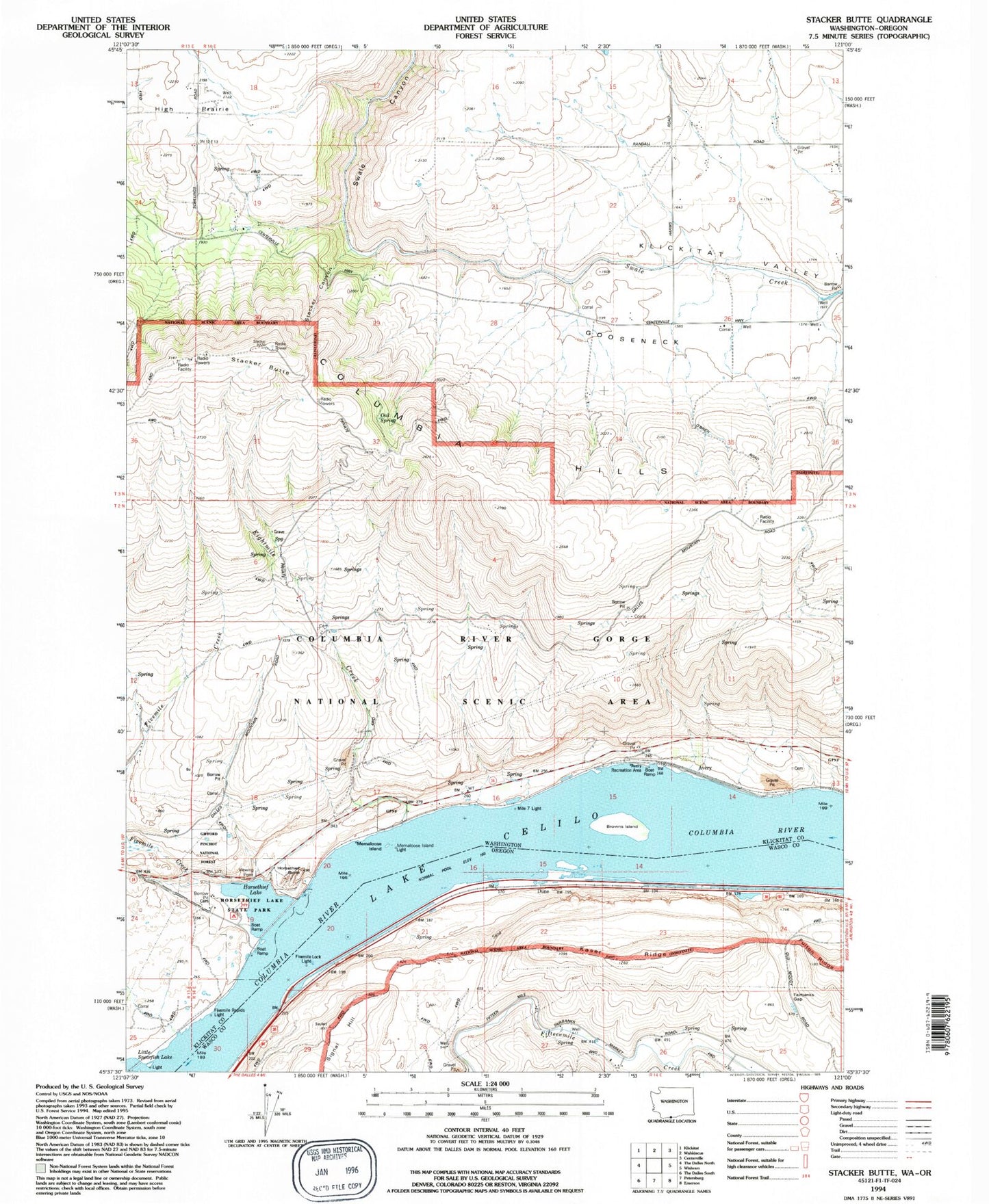
Classic USGS Stacker Butte Washington 7.5'x7.5' Topo Map
Couldn't load pickup availability
Historical USGS topographic quad map of Stacker Butte in the states of Washington, Oregon. Map scale may vary for some years, but is generally around 1:24,000. Print size is approximately 24" x 27"
This quadrangle is in the following counties: Klickitat, Wasco.
The map contains contour lines, roads, rivers, towns, and lakes. Printed on high-quality waterproof paper with UV fade-resistant inks, and shipped rolled.
Contains the following named places: Avery, Avery Recreation Area, Avery Treaty Fishing Access Site, Browns Island, Columbia Hills, Dune, Eightmile Creek, Fairbanks Gap, Fivemile Creek, Fivemile Lock Light, Fivemile Rapids, Fivemile Rapids Light, Gooseneck, Horsethief Butte, Horsethief Lake, Horsethief Lake State Park, Kaser Ridge, Lake Celilo, Memaloose Island Light, Mess House, Mile 7 Light, Oak Spring, Recreation Area, Stacker Butte, Stacker Canyon, Tenmile Rapids, The Dalles, The Dalles Unit, ZIP Code: 98673