MyTopo
Classic USGS Stafford New York 7.5'x7.5' Topo Map
Couldn't load pickup availability
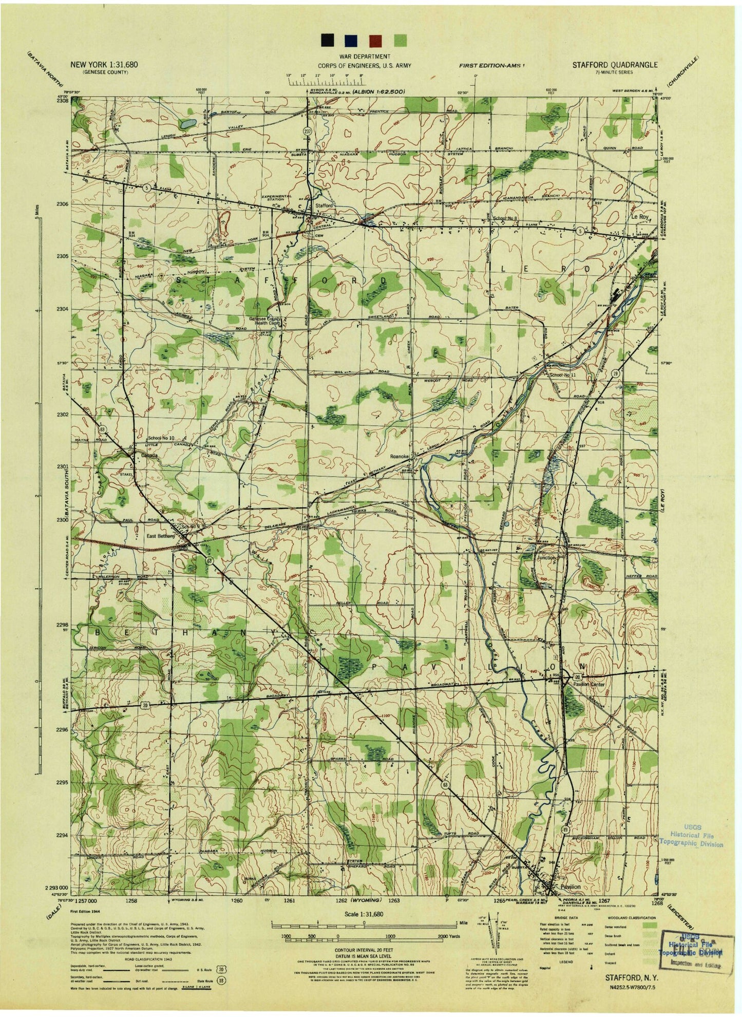
Historical USGS topographic quad map of Stafford in the state of New York. Map scale may vary for some years, but is generally around 1:24,000. Print size is approximately 24" x 27"
This quadrangle is in the following counties: Genesee.
The map contains contour lines, roads, rivers, towns, and lakes. Printed on high-quality waterproof paper with UV fade-resistant inks, and shipped rolled.
Contains the following named places: Batavia Drive-In, Bel-Air Ranch Health Camp, Burks Hill, Burleigh Hill, East Bethany, East Bethany Cemetery, East Bethany Presbyterian Church, Fairview Cemetery, Fargo Road Pioneer Cemetery, Immaculate Conception Church, Jug City Cemetery, Junction, Leroy Volunteer Ambulance Services, Little Canada, Millers Fruit Farm, Oatka Valley Cemetery, Pavilion, Pavilion Census Designated Place, Pavilion Center, Pavilion Post Office, Pavilion United Methodist Church, Roanoke, Roanoke Apple Farms, Saint Mary Church, Saint Pauls Episcopal Church, Scarff Hill, School Number 10, School Number 11, School Number 8, School Number 9, Skunk Hill, Stafford, Stafford Country Club, Stafford Post Office, Stafford Quarry, Stafford Rural Cemetery, Stafford Station, Stafford Village Four Corners Historic District, Stafford Volunteer Fire Department, Suicide Corners, Sweetland Pines Golf Course, Temperance Hill, Texaco Town, Top Of World Gardens And Greenhouse, Town of Pavilion, Town of Stafford, Transit Cemetery, Valley View Park, White Creek, ZIP Codes: 14143, 14525