MyTopo
Classic USGS Stairs Mountain New Hampshire 7.5'x7.5' Topo Map
Couldn't load pickup availability
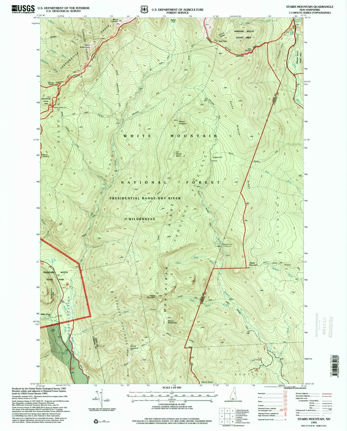
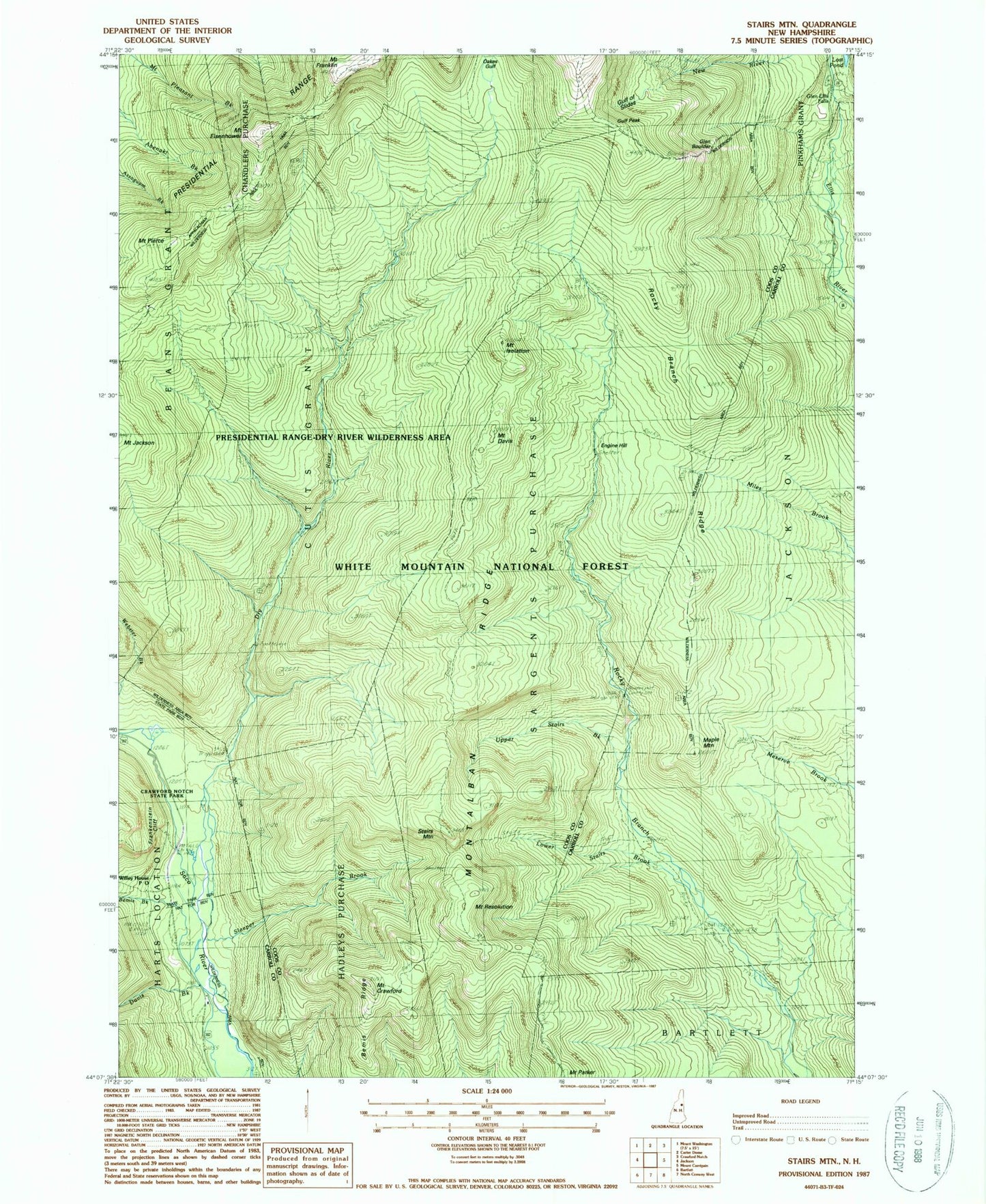
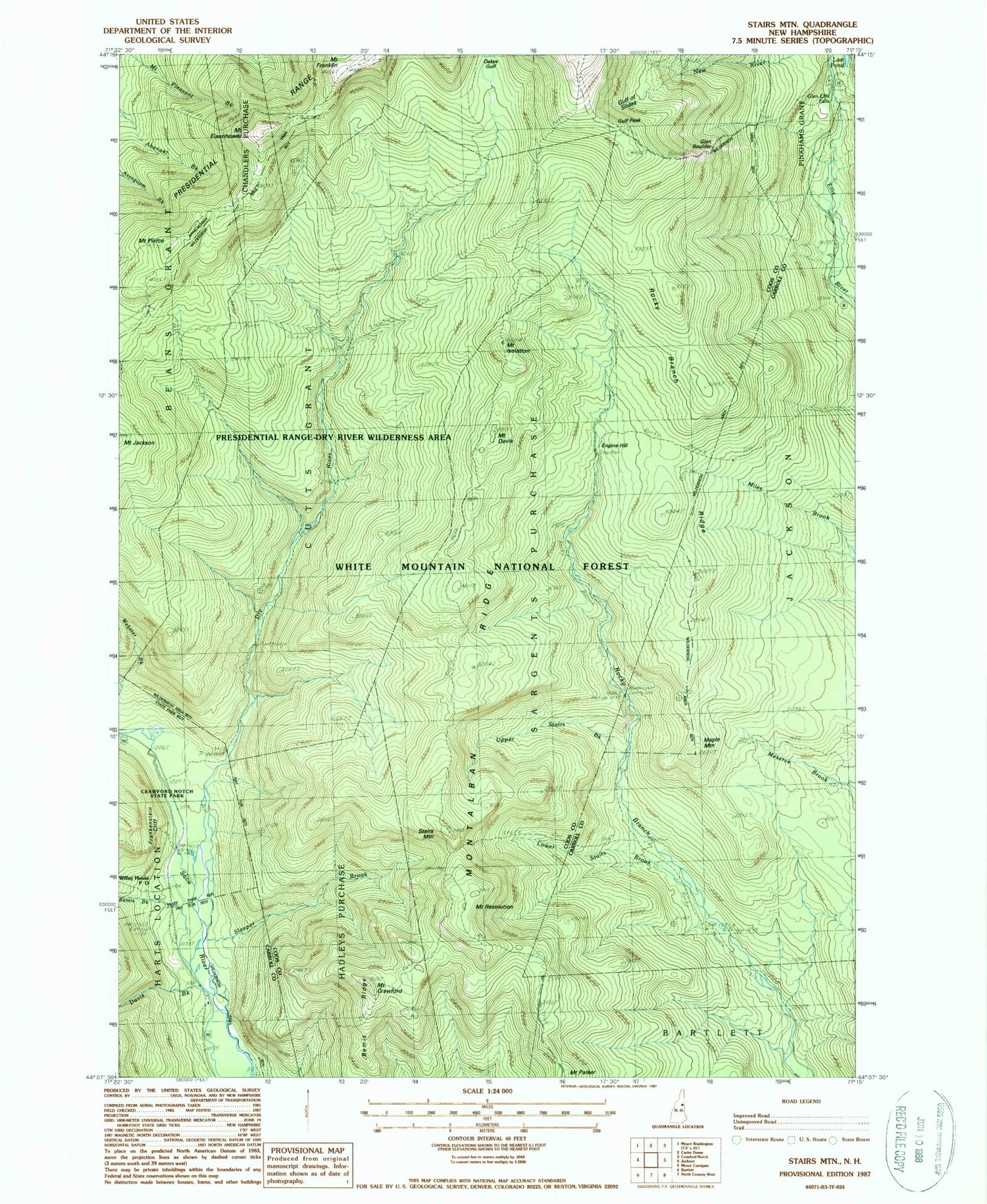
Historical USGS topographic quad map of Stairs Mountain in the state of New Hampshire. Typical map scale is 1:24,000, but may vary for certain years, if available. Print size: 24" x 27"
This quadrangle is in the following counties: Carroll, Coos.
The map contains contour lines, roads, rivers, towns, and lakes. Printed on high-quality waterproof paper with UV fade-resistant inks, and shipped rolled.
Contains the following named places: Bemis Brook, Bemis Ridge, Rocky Branch Ridge, Crawford Path, Mount Crawford, Davis Brook, Davis Path, Mount Davis, Desolation Pond, Dry River, Dry River Trail, Edmands Path, Mount Eisenhower, Engine Hill, Frankenstein Cliff, Giant Stairs, Glen Boulder, Glen Boulder Trail, Glen Ellis Falls, Gulf of Slides, Gulf Peak, Hadleys Purchase, Town of Hart's Location, Isolation Shelter, Isolation Trail, Mount Isolation, Lower Stairs Brook, Maple Mountain, Miles Brook Trail, Mizpah Spring Hut, Montalban Ridge, Mount Clinton Trail, Mount Parker Trail, Mount Pleasant Trail, Oakes Gulf, Oakes Gulf Trail, Mount Pierce, Presidential Range, Resolution Shelter, Mount Resolution, Rocky Branch Ridge, Rocky Branch Trail, Sargents Purchase, Shelter Number One, Shelter Number One, Shelter Number Two, Shelter Number Two, Sleeper Brook, Stairs Brook Trail, Stairs Col Trail, Stairs Mountain, Upper Stairs Brook, Willey House Post Office, Lost Pond, Presidential Range-Dry River Wilderness, Dry River Campground, Mount Eisenhower Trail, Glen Ellis Falls Picnic Area, Otis Brook, Rocky Branch Number One WMNF Shelter, Cutts Grant, Dry River Camping Area, Glen Ellis Falls Scenic Area