MyTopo
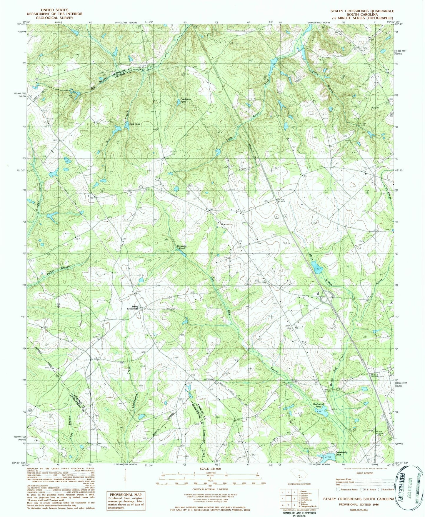
Classic USGS Staley Crossroads South Carolina 7.5'x7.5' Topo Map
Couldn't load pickup availability
Historical USGS topographic quad map of Staley Crossroads in the state of South Carolina. Map scale may vary for some years, but is generally around 1:24,000. Print size is approximately 24" x 27"
This quadrangle is in the following counties: Calhoun, Lexington, Orangeburg.
The map contains contour lines, roads, rivers, towns, and lakes. Printed on high-quality waterproof paper with UV fade-resistant inks, and shipped rolled.
Contains the following named places: A S Smoak Pond, A S Smoak Pond Dam D-2676, Alan's Airport, Andrew Chapel, Beaver Creek School, Belleville Fire Department Substation, Bethel Church, Bethlehem Church, Bethlehem Elementary School, Bethlehem School, Beulah Church, Brakefield Pond, Brakefield Pond Dam D-2675, Briar Head School, Caw Caw Fire Department, Center Hill School, Crim Creek, Crim Pond, Crowder Pond, Culclosure Pond, D H Wannamaker Pond, Do-Little Field, Falls Branch, Gethsemane Church, Glovers Chapel, Gressett House Pond, Gressette Pond, Howell Branch, Interchange 136, Mack Branch, Morefield Pond, Morefields Pond Dam D-2617, Mount Nebo Church, Mount Nebo School, Murph Mill Creek, Nazarene School, Old Way Pond, Otts Pond, Otts Pond Dam D-2677, Powerline Pond, Prodigal Church, Providence Church, Rast Pond, Redmond Pond, Rock Branch, Rowe School, Ruckers Pond, Saint Peters Church, Saint Peters School, Sandy Run-Staley Crossroads Division, Smiths Falls Pond, South Carolina Noname 09003 D-2616 Dam, South Carolina Noname 09005 D-2618 Dam, South Carolina Noname 09006 D-2917 Dam, South Carolina Noname 09007 D-2619 Dam, South Carolina Noname 09008 D-2621 Dam, South Carolina Noname 09016 D-2632 Dam, South Carolina Noname 09017 D-2918 Dam, South Carolina Noname 09018 D-2633 Dam, South Carolina Noname 09020 D-2634 Dam, Staley Crossroads, Staley Pond, Strawberry Pond, Strawberry Pond Dam D-2674, Sunny Plain School, Sweetwater Lake, Upper Center Hill School, Wannamakers Upper I-26 Pond, Wesley Chapel, Willie Rucker Pond