MyTopo
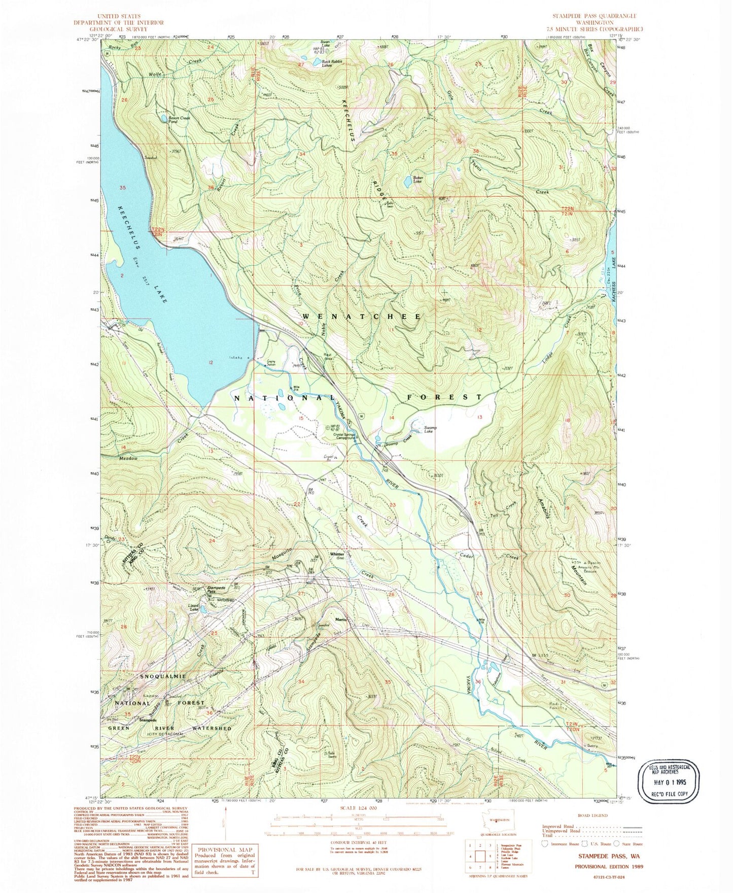
Classic USGS Stampede Pass Washington 7.5'x7.5' Topo Map
Couldn't load pickup availability
Historical USGS topographic quad map of Stampede Pass in the state of Washington. Typical map scale is 1:24,000, but may vary for certain years, if available. Print size: 24" x 27"
This quadrangle is in the following counties: King, Kittitas.
The map contains contour lines, roads, rivers, towns, and lakes. Printed on high-quality waterproof paper with UV fade-resistant inks, and shipped rolled.
Contains the following named places: Amabilis Mountain, Baker Lake, Cedar Creek, Crystal Springs Campground, Kachess Guard Station, Keechelus Dam, Keechelus Lake, Keechelus Ridge, Lizard Lake, Lodge Creek, Martin, Meadow Creek, Mosquito Creek, Noble Creek, Price Creek, Resort Creek, Resort Creek Pond, Roaring Creek, Rock Rabbit Lakes, Rocky Run Guard Station, Stampede, Stampede Pass, Stampede Tunnel, Swamp Lake, Thetis Creek, Toll Creek, Whittier, Wolfe Creek, Telephone Creek, Kachess Sno-Park, Kachess Resort, Bakers Camp, Cabin Creek Sno-Park, Stampede Pass, Keechelus, Lake Keechelus Snowshed Tunnel, Kittitas County Fire District 8 Station 82, Kittitas County Fire District 8 Station 83, Houle Creek