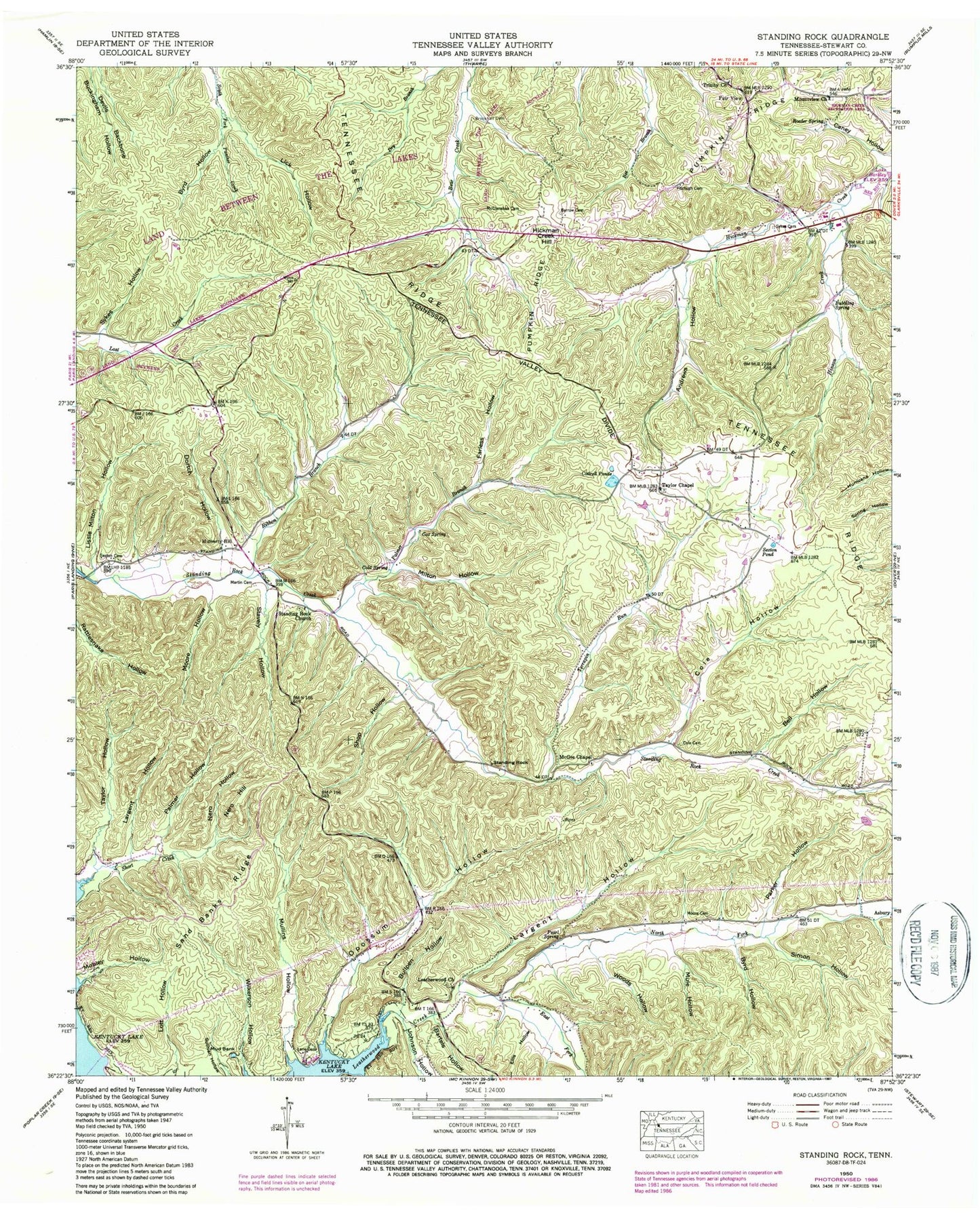
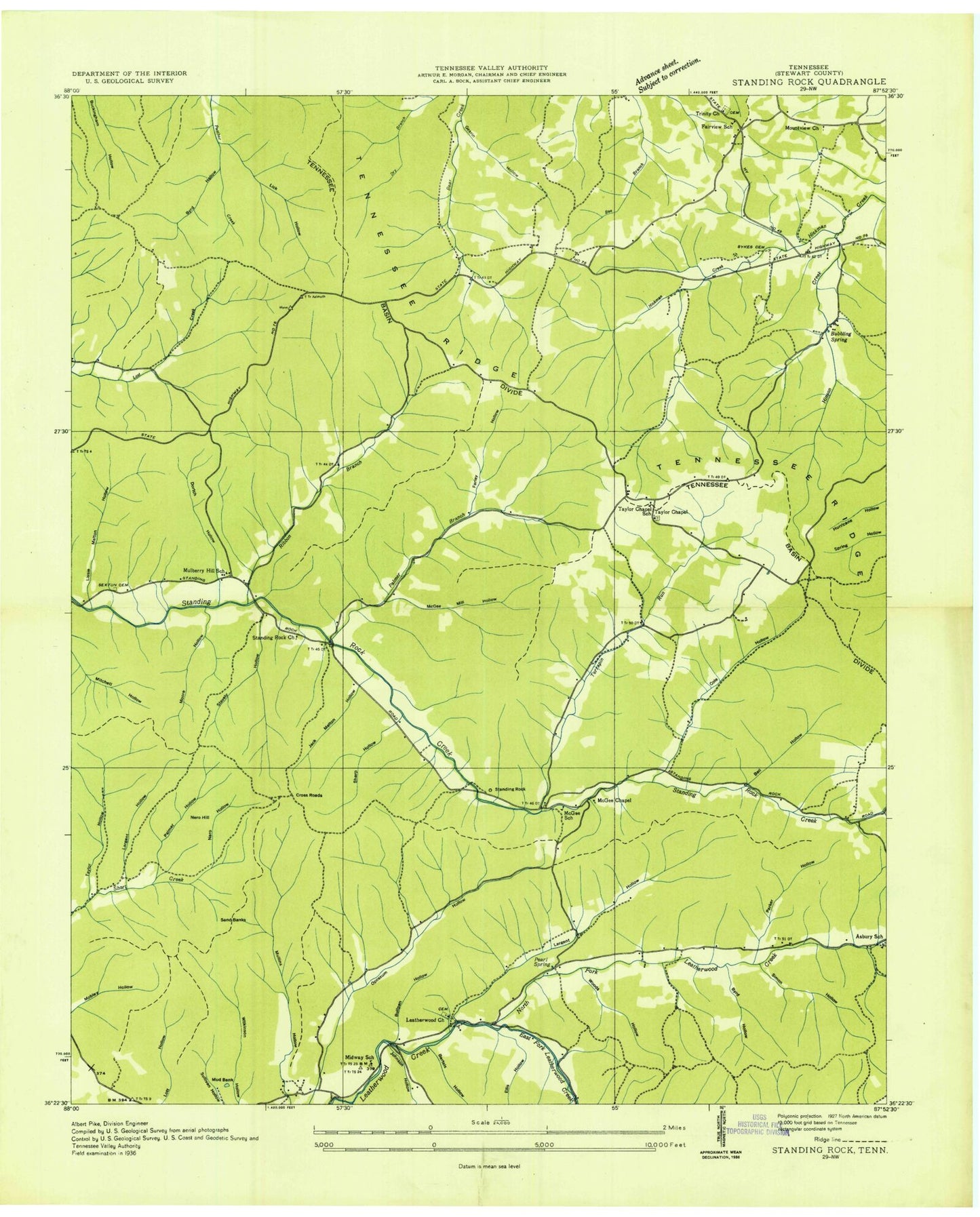
MyTopo
Classic USGS Standing Rock Tennessee 7.5'x7.5' Topo Map
Couldn't load pickup availability
Historical USGS topographic quad map of Standing Rock in the state of Tennessee. Typical map scale is 1:24,000, but may vary for certain years, if available. Print size: 24" x 27"
This quadrangle is in the following counties: Stewart.
The map contains contour lines, roads, rivers, towns, and lakes. Printed on high-quality waterproof paper with UV fade-resistant inks, and shipped rolled.
Contains the following named places: East Fork Leatherwood Creek, Ellis Hollow, Simon Hollow, Standing Rock, Stavely Hollow, Sykes Cemetery, Sykes Hollow, Taylor Hollow, Terrapin Run, Woods Hollow, Andrews Hollow, Barrow Cemetery, Bartels Hollow, Bell Hollow, Brookhall Cemetery, Bubbling Spring, Bullpen Hollow, Byrd Hollow, Byrd Hollow, Caney Hollow, Cold Spring, Cole Cemetery, Cottrell Ponds, Cox Spring, Devils Backbone, Dortch Hollow, Farless Hollow, Fitzhugh Cemetery, Hickman Creek Hill, Hinson Creek, Johnson Hollow, Lane Cemetery, Largent Hollow, Largent Hollow, Lick Hollow, Lissie Milton Hollow, Soloman Dawson Cemetery, McClanahan Cemetery, McGee Chapel, Milton Hollow, Mobley Hollow, Moore Cemetery, Moore Hollow, Mountview Church, Mulberry Hill, Mule Hollow, Mullins Hollow, Nero Hill, Nero Hollow, North Fork Leatherwood Creek, Opossum Hollow, Palmer Branch, Palmer Hollow, Parker Hollow, Pearl Spring, Pumpkin Ridge, Ribbon Branch, Roeder Spring, Sand Banks Ridge, Sexton Cemetery, Sexton Pond, Shop Hollow, Standing Rock Church, Taylor Chapel, Trinity United Methodist Church, Leatherwood Church, Asbury School (historical), Clark Furnace (historical), Clark Furnace Mines, Cross Roads, Fairview School (historical), Gearin Hollow, Jack Melton Hollow, Leatherwood Dock, McGee School (historical), Midway School (historical), Mud Bank Mine, Mulberry Hill School (historical), Old Tunnel Mine, Peytonia Furnace (historical), Taylor Chapel School (historical), Asbury, Fair View, Leatherwood Cemetery, Mountview Cemetery, Standing Rock Cemetery, Trinity Cemetery, Cox Hollow, Keel Hollow, Commissioner District 5, Dover - Stewart County Rescue Squad, Stewart County Fire Rescue Station 9, Stewart County Fire Rescue Station 4, Short Creek Airport