MyTopo
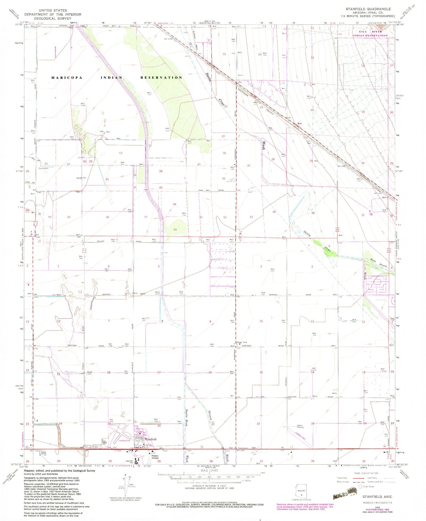
Classic USGS Stanfield Arizona 7.5'x7.5' Topo Map
Couldn't load pickup availability
Historical USGS topographic quad map of Stanfield in the state of Arizona. Map scale may vary for some years, but is generally around 1:24,000. Print size is approximately 24" x 27"
This quadrangle is in the following counties: Pinal.
The map contains contour lines, roads, rivers, towns, and lakes. Printed on high-quality waterproof paper with UV fade-resistant inks, and shipped rolled.
Contains the following named places: Ak-Chin Regional Airport, Ben Railroad Station, Bon, Casa Grande Valley, Greene Wash, Indian Assembly of God, North Branch Santa Cruz Wash, Pinal County Sheriff's Office Stanfield Region C, Potters Field, Santa Rosa Wash, Stanfield, Stanfield Census Designated Place, Stanfield Elementary School, Stanfield Post Office, Stanfield Volunteer Fire Department, ZIP Code: 85172