MyTopo
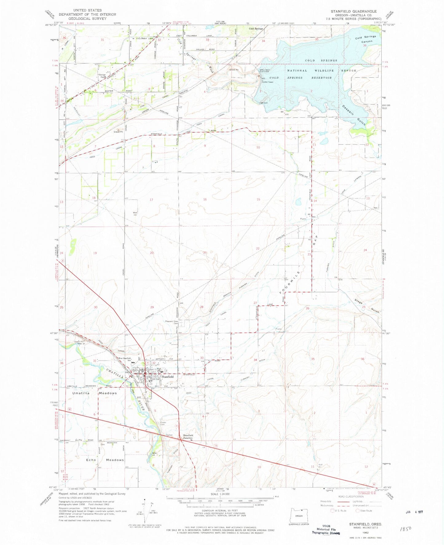
Classic USGS Stanfield Oregon 7.5'x7.5' Topo Map
Couldn't load pickup availability
Historical USGS topographic quad map of Stanfield in the state of Oregon. Map scale may vary for some years, but is generally around 1:24,000. Print size is approximately 24" x 27"
This quadrangle is in the following counties: Umatilla.
The map contains contour lines, roads, rivers, towns, and lakes. Printed on high-quality waterproof paper with UV fade-resistant inks, and shipped rolled.
Contains the following named places: Bard Park, Baumgardner Cemetery, Charlotte Rauch Park, City of Stanfield, Coe Street Park, Cold Springs Canyon, Cold Springs Dam, Cold Springs National Wildlife Refuge, Cold Springs Reservoir, Columbia Grange Hall, Despain Gulch, Echo Wastewater Treatment Plant, Foster Cemetery, Fosters, Fourmile Gap, Furnish Ditch, Hermiston Fire and Emergency Services Station 2, L Canal, Lenz Lateral, Meadowville Post Office, Moorhouse Post Office, Pleasant View Cemetery, South Point Boat Launch, Stage Gulch, Stanfield, Stanfield Branch Furnish Ditch, Stanfield City Hall, Stanfield Drain, Stanfield Elementary School, Stanfield Fire Department, Stanfield Heights Park, Stanfield Junction, Stanfield Junior High School, Stanfield Municipal Court, Stanfield Police Department, Stanfield Post Office, Stanfield Public Library, Stanfield Public Works Department, Stanfield Secondary School, Stanfield Wastewater Treatment Facility, U S B Line Canal, Walchli Dam, Walchli Reservoir, West Stanfield School, ZIP Code: 97875