MyTopo
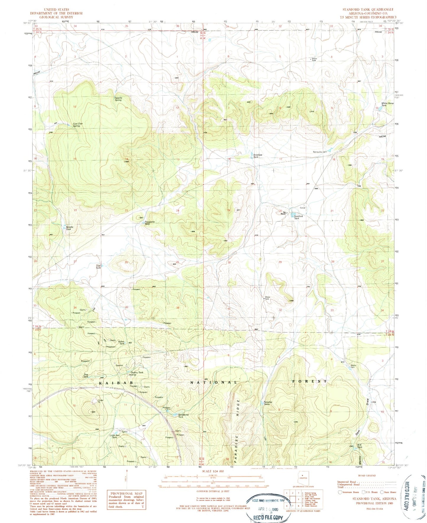
Classic USGS Stanford Tank Arizona 7.5'x7.5' Topo Map
Couldn't load pickup availability
Historical USGS topographic quad map of Stanford Tank in the state of Arizona. Map scale may vary for some years, but is generally around 1:24,000. Print size is approximately 24" x 27"
This quadrangle is in the following counties: Coconino.
The map contains contour lines, roads, rivers, towns, and lakes. Printed on high-quality waterproof paper with UV fade-resistant inks, and shipped rolled.
Contains the following named places: Aja Ranch, Antelope Tank, Apache Spring, Barney Dry Dam, Chinese Tank, Con Clair Spring, Doe Tank, Indian Tank, Jimmy Tank, Little Aso Tank, M K Tank, Martin Dam, Martin Dam Draw, Paradise Tanks, Pouquette Tank, Quarry Tank, Reneke Tank, Sandstone Tank, Stanford Tank, Tom Tank, Upper Sandstone Tank, White Horse Tank