MyTopo
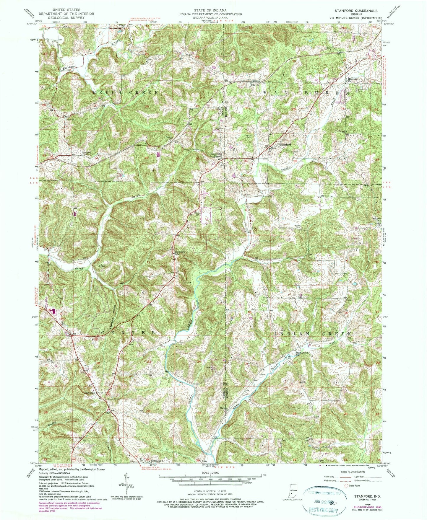
Classic USGS Stanford Indiana 7.5'x7.5' Topo Map
Couldn't load pickup availability
Historical USGS topographic quad map of Stanford in the state of Indiana. Map scale may vary for some years, but is generally around 1:24,000. Print size is approximately 24" x 27"
This quadrangle is in the following counties: Greene, Monroe.
The map contains contour lines, roads, rivers, towns, and lakes. Printed on high-quality waterproof paper with UV fade-resistant inks, and shipped rolled.
Contains the following named places: Buenavista, Buenavista Church, Burch Cemetery, Carmichael Cemetery, Center Township Volunteer Fire Department, Cincinnati, Edwards Cemetery, Elwren, Gardner Cemetery, Greene County Chapel, Greene County Chapel Cemetery, Harmony Cemetery, Harmony Church, Hebron Church, Keller Cemetery, Lawrence Hollow, Little Indian Creek, Mount Zion Church, Sanbourn School, Solsberry Cemetery, Stanford, Stanford Post Office, Township of Indian Creek, Township of Van Buren, Union Church, Van Buren Township Fire Department Station 19, ZIP Code: 47459