MyTopo
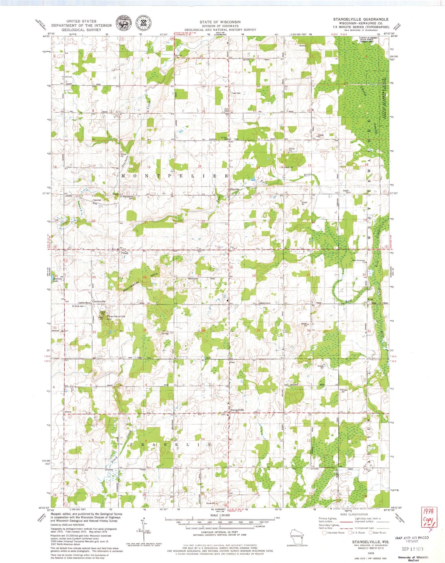
Classic USGS Stangelville Wisconsin 7.5'x7.5' Topo Map
Couldn't load pickup availability
Historical USGS topographic quad map of Stangelville in the state of Wisconsin. Map scale may vary for some years, but is generally around 1:24,000. Print size is approximately 24" x 27"
This quadrangle is in the following counties: Kewaunee.
The map contains contour lines, roads, rivers, towns, and lakes. Printed on high-quality waterproof paper with UV fade-resistant inks, and shipped rolled.
Contains the following named places: Beech Grove School, Chernesville School, Cherneyville, Cherneyville Hill, Chervenka Farms, Ellisville, Fairview Farms, Hallada Lake, High Bluff School, Jefferson School, Krok, Krok Creek, Lipsky Swamp, Montpelier Hills, Montpelier Township Cemetery, Phillip School, Pilsen, Pilsen School, Rolling Hills Dairy Farm, Saint Anna Cemetery, Saint John Catholic Church, Saint John Nepomucene Cemetery, Saint Joseph Catholic Cemetery, Saint Joseph Catholic Church, Saint Lawrence Catholic Cemetery, Saint Lawrence Catholic Church, Saint Paul Lutheran Cemetery, Saint Paul Lutheran School, Saint Pauls Lutheran Church, Saint Wenceslaus Cemetery, Salzsieder Farms, School Lane Dairy, Stangelville, Town of Montpelier, Valley View Dairy, West Kewaunee United Methodist Church, White Ledge Dairy, Whittier School, Woodland School, Zion Cemetery