MyTopo
USGS Classic Stanley Lake Idaho 7.5'x7.5' Topo Map
Couldn't load pickup availability
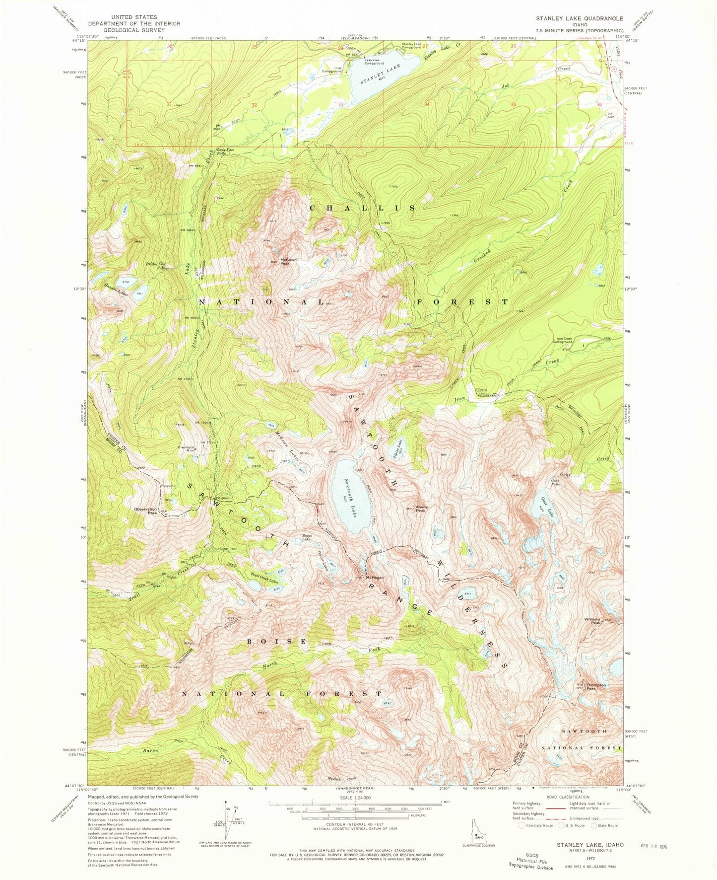
Historical USGS topographic quad map of Stanley Lake in the state of Idaho. Scale: 1:24000. Print size: 24" x 27"
This quadrangle is in the following counties: Boise, Custer.
The map contains contour lines, roads, rivers, towns, lakes, and grids including latitude / longitude and UTM / MGRS. Printed on high-quality waterproof paper with UV fade-resistant inks.
Contains the following named places: Alpine Peak, Bridal Veil Falls, Goat Falls, Goat Lake, Greenback Mine, Hanson Lakes, Inlet Campground, Iron Creek Campground, Job Creek, Lake View Campground, North Fork Baron Creek, Observation Peak, Mount Regan, Sawtooth Lake, Sawtooth Range, Stanley Lake, Trail Creek Lakes, Williams Peak, Lady Face Falls, Alpine Lake, Stanley Lake Campground, Trailer Lakes, McGown Lakes, McGowan Peak, Regan Lake, Thompson Peak, Stanley Lake Fish Barrier Dam