MyTopo
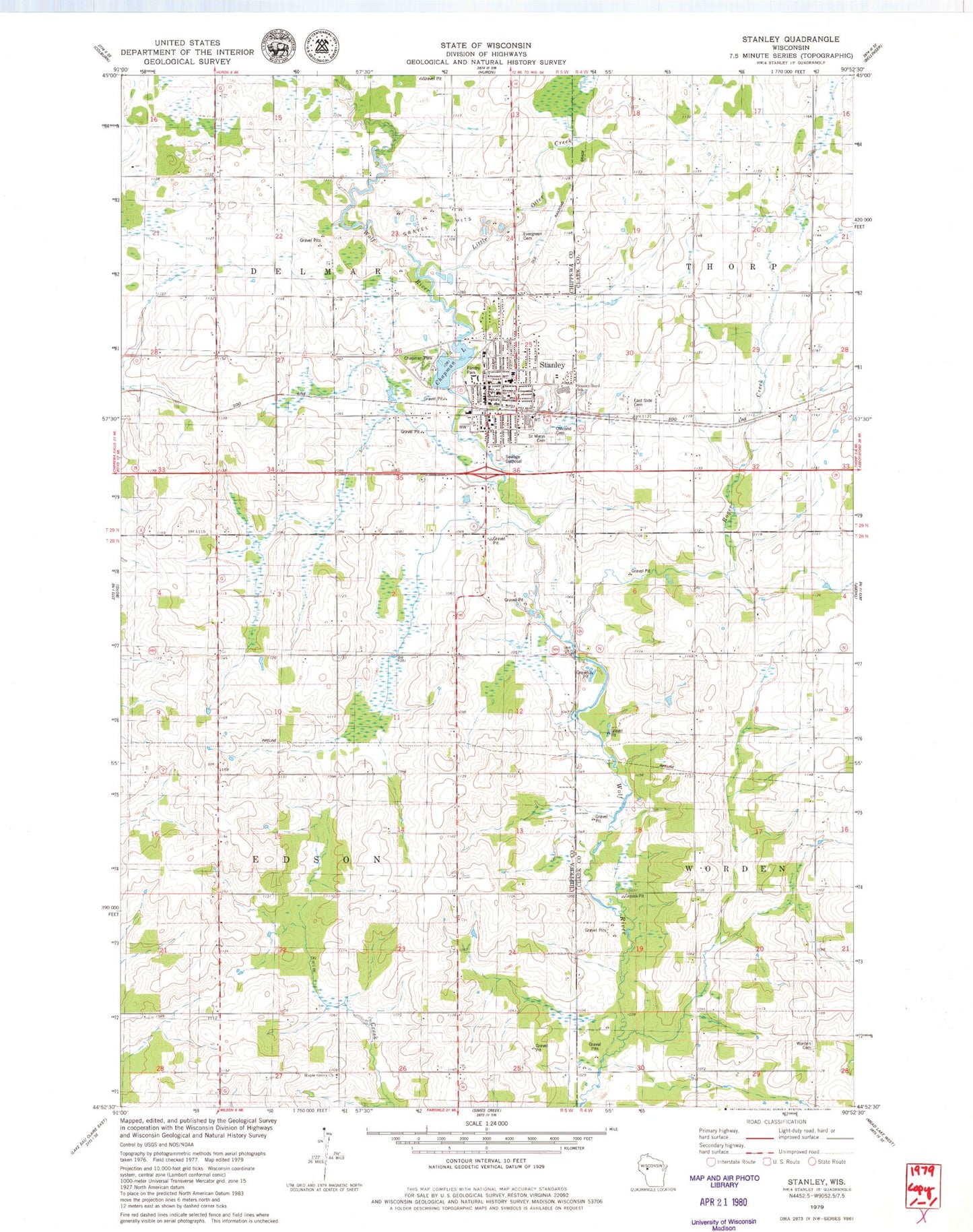
Classic USGS Stanley Wisconsin 7.5'x7.5' Topo Map
Couldn't load pickup availability
Historical USGS topographic quad map of Stanley in the state of Wisconsin. Map scale may vary for some years, but is generally around 1:24,000. Print size is approximately 24" x 27"
This quadrangle is in the following counties: Chippewa, Clark.
The map contains contour lines, roads, rivers, towns, and lakes. Printed on high-quality waterproof paper with UV fade-resistant inks, and shipped rolled.
Contains the following named places: Ascension Our Lady of Victory Hospital, Black Creek Valley School, Boyd-Stanley Catholic Church, Chapman Lake, Chapman Park, Church of God, Church of the Brethren, City of Stanley, D R Moon Memorial Library, East Side Cemetery, Edson Church, Epiphany Lutheran School, Evergreen Cemetery, Fagan School, Faith Christian Academy, Faith Evangelical Free Church, Fandry Park, First Presbyterian Church, Garfield School, High Banks School, Holy Family Catholic Church, Lincoln School, Little Otter Creek, Oakland Cemetery, Otter Creek School, Our Saviours Lutheran Church, Peterson School, Riverview School, Robinson School, Roger Creek, Roger Creek School, Saint Anns Roman Catholic Church, Saint Anns School, Saint Marys Cemetery, Saint Marys Roman Catholic Church, Schmidt Maple Woods State Natural Area, Sol Mohr School, Stanley, Stanley - Boyd Elementary School, Stanley - Boyd Middle School, Stanley Boyd High School, Stanley Correctional Institution, Stanley Correctional Institution School, Stanley Fire Department, Stanley Mill Dam, Stanley Police Department, Stanley Post Office, Stanley Wastewater Treatment Facility, Trinity Christian Fellowship Church, Victory Memorial Hospital Heliport, Worden, Worden Cemetery, Worden Church, ZIP Code: 54768