MyTopo
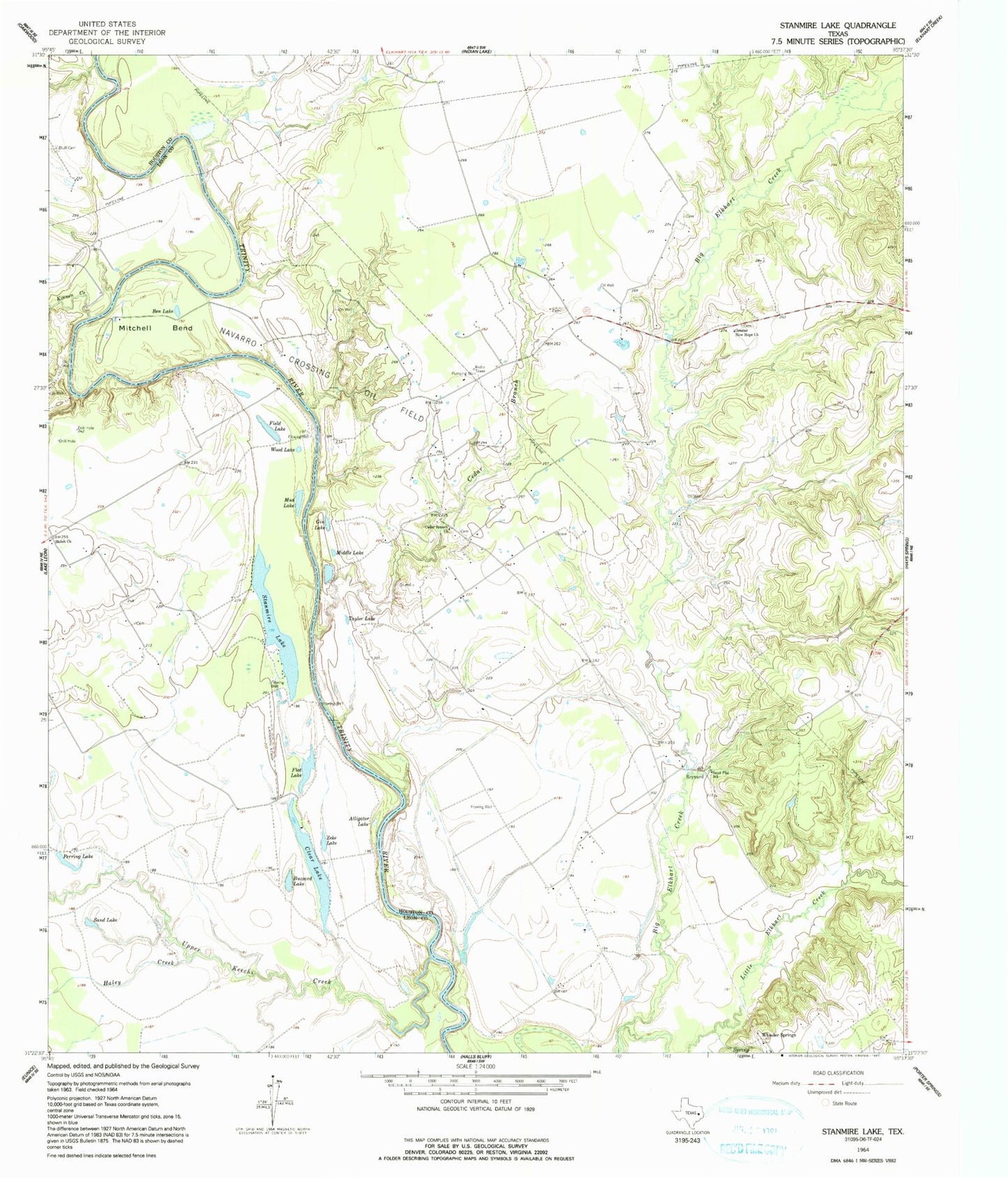
Classic USGS Stanmire Lake Texas 7.5'x7.5' Topo Map
Couldn't load pickup availability
Historical USGS topographic quad map of Stanmire Lake in the state of Texas. Map scale may vary for some years, but is generally around 1:24,000. Print size is approximately 24" x 27"
This quadrangle is in the following counties: Houston, Leon.
The map contains contour lines, roads, rivers, towns, and lakes. Printed on high-quality waterproof paper with UV fade-resistant inks, and shipped rolled.
Contains the following named places: Alligator Lake, Ben Lake, Bluff Cemetery, Buzzard Lake, Cedar Branch, Cedar Branch Church, Chiles Branch, Clear Lake, Field Lake, Flat Lake, Gin Lake, Greater New Hope Church, Haley Creek, Kent Hill, Kinnon Creek, Little Elkhart Creek, Meriwether Branch, Middle Lake, Mitchell Bend, Mud Lake, Murchison Branch, Navarro Crossing Oil Field, Old Dailey Family Cemetery, Perring Lake, Reynard, Sand Flat School, Sand Lake, Shiloh Church, Stanmire Lake, Taylor Lake, Upper Keechi Creek, W C Ranch Airport, Wes Hicks Cemetery, Wheeler Springs, Wood Lake, Zeke Lake