
MyTopo
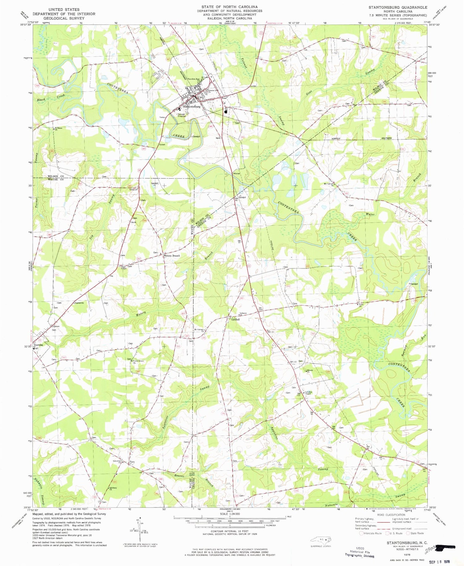
Classic USGS Stantonsburg North Carolina 7.5'x7.5' Topo Map
Couldn't load pickup availability
Historical USGS topographic quad map of Stantonsburg in the state of North Carolina. Map scale may vary for some years, but is generally around 1:24,000. Print size is approximately 24" x 27"
This quadrangle is in the following counties: Greene, Wayne, Wilson.
The map contains contour lines, roads, rivers, towns, and lakes. Printed on high-quality waterproof paper with UV fade-resistant inks, and shipped rolled.
Contains the following named places: Appletree Swamp, Beaman Run, Black Creek, Bull Head Rural Volunteer Fire Department, Diggs Chapel, Eureka Elementary School, Faith Church, Faro, Faro Volunteer Fire Department - Northeast Station 1, Goss Swamp, Greater Zion Church, Ivy Swamp, Lebanon Church, Levelton Chapel, Lindell, Miracle Church, Mount Calvary Church, Saint James Church, Saint Lukes Church, Salisbury Church, Stantonsburg, Stantonsburg Elementary School, Stantonsburg Emergency Medical Services, Stantonsburg Moyton Volunteer Fire Department Station 3, Stantonsburg Police Department, Stantonsburg Post Office, Toisnot Swamp, Town of Stantonsburg, Township of Bull Head, Travelers Rest Church, Turner Swamp, Union Grove Church, Water Branch, Watery Branch, Yelverton Church, ZIP Code: 27883


