MyTopo
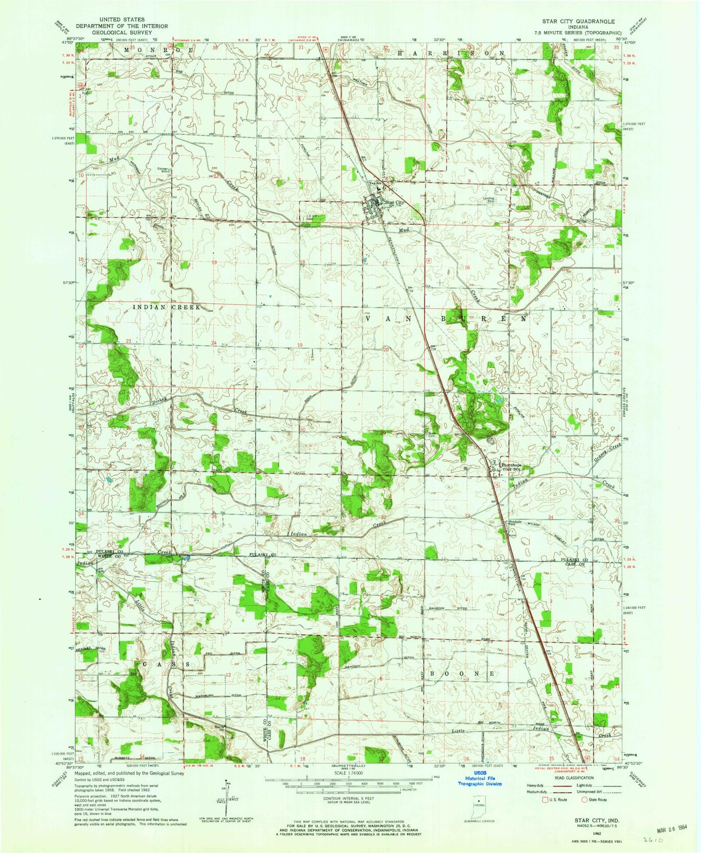
Classic USGS Star City Indiana 7.5'x7.5' Topo Map
Couldn't load pickup availability
Historical USGS topographic quad map of Star City in the state of Indiana. Map scale may vary for some years, but is generally around 1:24,000. Print size is approximately 24" x 27"
This quadrangle is in the following counties: Cass, Pulaski, White.
The map contains contour lines, roads, rivers, towns, and lakes. Printed on high-quality waterproof paper with UV fade-resistant inks, and shipped rolled.
Contains the following named places: Bonnell Number Two Ditch, Buck Cemetery, Fredricks Ditch, Grassy Creek, Hancock Ditch, Hoffman Ditch, Little Indian Creek, Moon Ditch, Mount Pleasant Cemetery, Oak Post Office, Prather Ditch, Skillen Ditch, Star City, Star City Census Designated Place, Star City Post Office, Star City Van Buren Township Volunteer Fire Department, Star City West Cemetery, Stout Gise Ditch, Thornhope, Township of Van Buren, Washburn Ditch, Wilson Wiseley Ditch, ZIP Code: 46985