MyTopo
Classic USGS Star Peak Nevada 7.5'x7.5' Topo Map
Couldn't load pickup availability
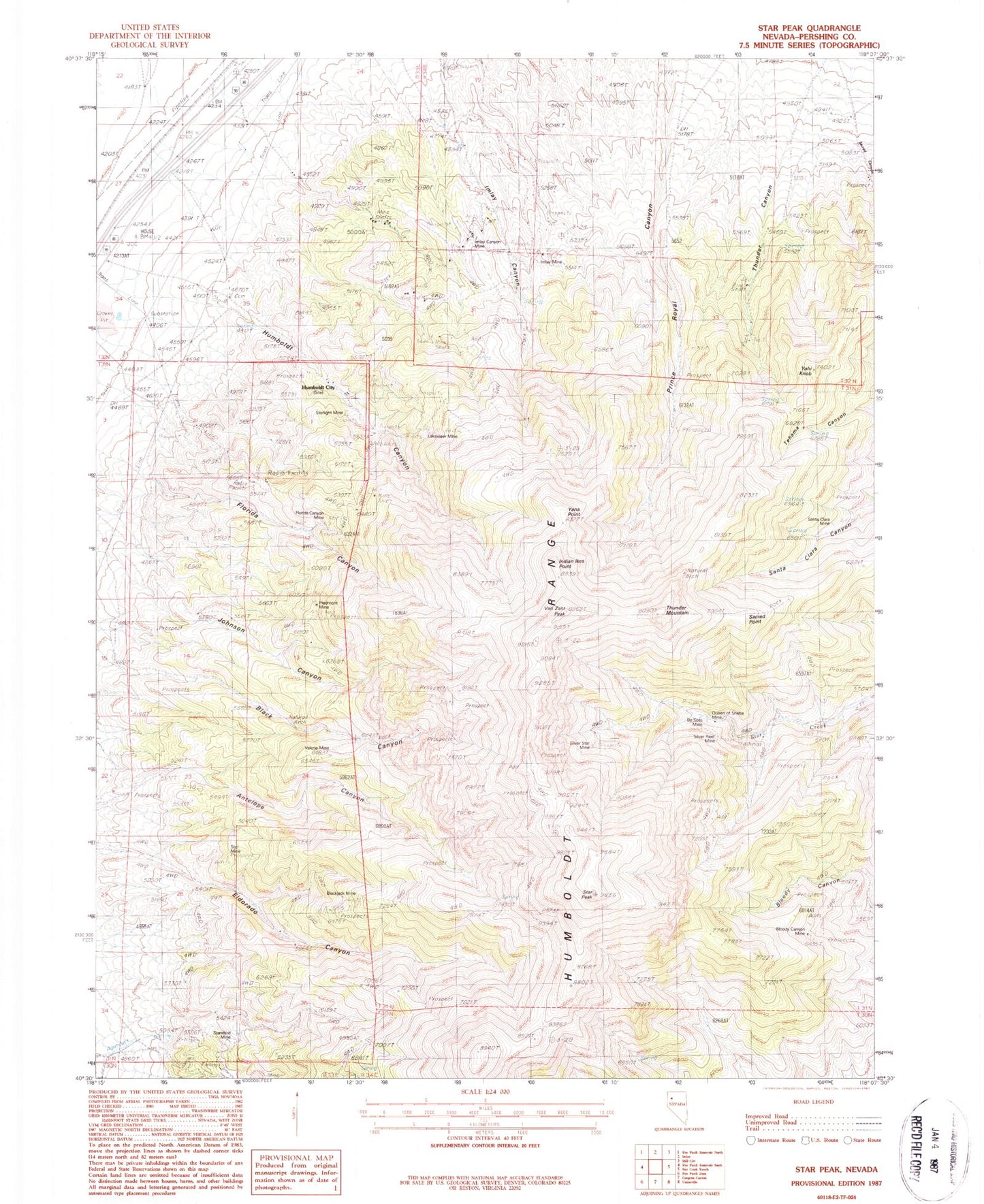
Historical USGS topographic quad map of Star Peak in the state of Nevada. Map scale may vary for some years, but is generally around 1:24,000. Print size is approximately 24" x 27"
This quadrangle is in the following counties: Pershing.
The map contains contour lines, roads, rivers, towns, and lakes. Printed on high-quality waterproof paper with UV fade-resistant inks, and shipped rolled.
Contains the following named places: Antelope Canyon, Antelope Canyon Mine, Atoka, Black Canyon, Blackjack Mine, Bloody Canyon Mine, Bloody Mine, DeSoto Mine, Eldorado Canyon, Florida Canyon, Florida Canyon Mine, Fluorspar Mine, Gold King Mine, Golden Jacket Mines, Humboldt Canyon, Humboldt City, Humboldt City Post Office, Imlay Canyon, Imlay Canyon Mine, Imlay Mine, Imlay Mining District, Indian Ikes Point, Johnson Canyon, Lakeview Mine, McGee Mine, Motor Mine, Pflum Mine, Piedmont Mine, Prince Royal, Queen of Sheba Mine, Ruby, Sacred Canyon, Sacred Point, Santa Clara Mine, Silver Reef Mine, Silver Star Mine, Standard Mine, Star City, Star City Post Office, Star Mine, Star Peak, Star Peak Mine, Starlight Mine, Sulfur Mine, Thunder Canyon, Thunder Mountain, Twain, Valerie Mine, Van Zant Peak, Yahi Knob, Yana Point