MyTopo
Classic USGS Star Mississippi 7.5'x7.5' Topo Map
Couldn't load pickup availability
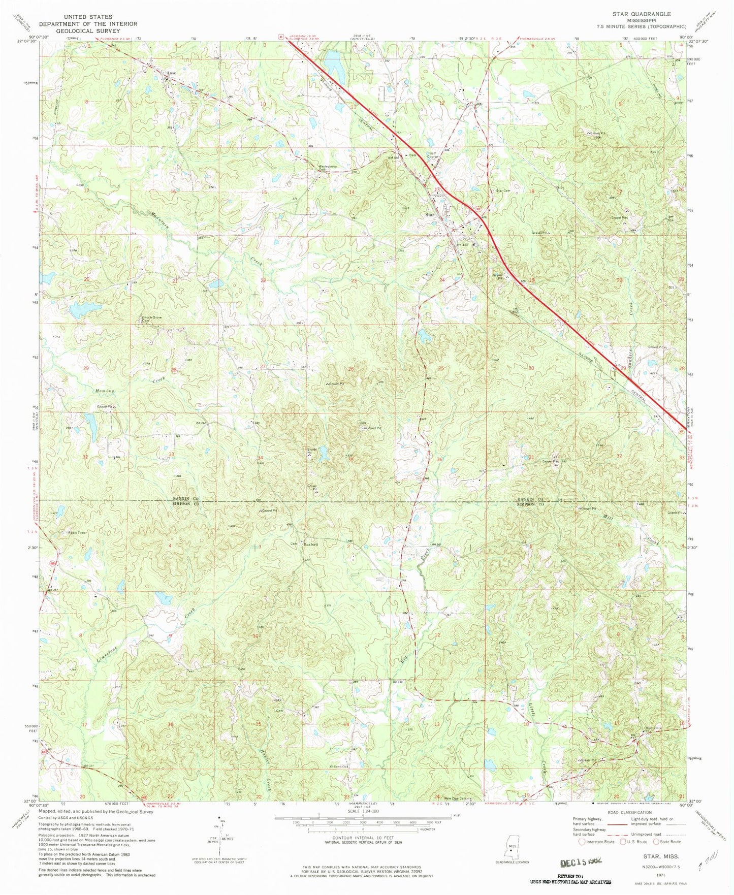
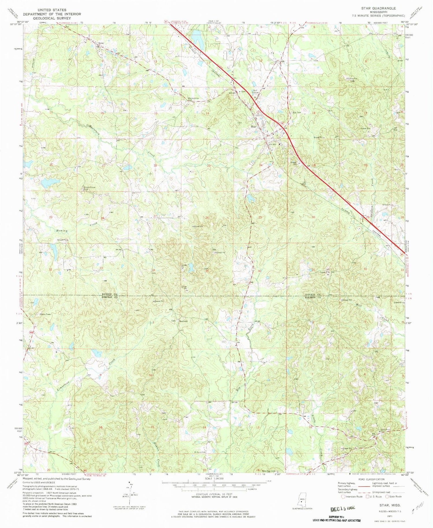
Historical USGS topographic quad map of Star in the state of Mississippi. Map scale may vary for some years, but is generally around 1:24,000. Print size is approximately 24" x 27"
This quadrangle is in the following counties: Rankin, Simpson.
The map contains contour lines, roads, rivers, towns, and lakes. Printed on high-quality waterproof paper with UV fade-resistant inks, and shipped rolled.
Contains the following named places: Anse, Belles Store, Bishops Lake Dam, Campbellite Cemetery, Campbellite Church, Comeby, Corley Lake Dam, Crenshaw Lake Dam, Dane, Enoch Grove Cemetery, Enoch Grove Church, Falcon Field, Fridge Lake Dam, Gama, Holly Grove Baptist Church, Holly Grove Cemetery, Lake Shores Lake Dam, Middleton Field Cemetery, Morning Star Cemetery, Mount Salem Church, New Zion Cemetery, New Zion Church, Oak Hill School, Rexford, Rexford Cemetery, Rexford Methodist Church, Ridgway Management Lake Dam, Rockhill School, Sardis School, Star, Star Cemetery, Star Post Office, Star Volunteer Fire Department, Wesleyanna Cemetery, Wesleyanna Church, ZIP Code: 39167