
MyTopo
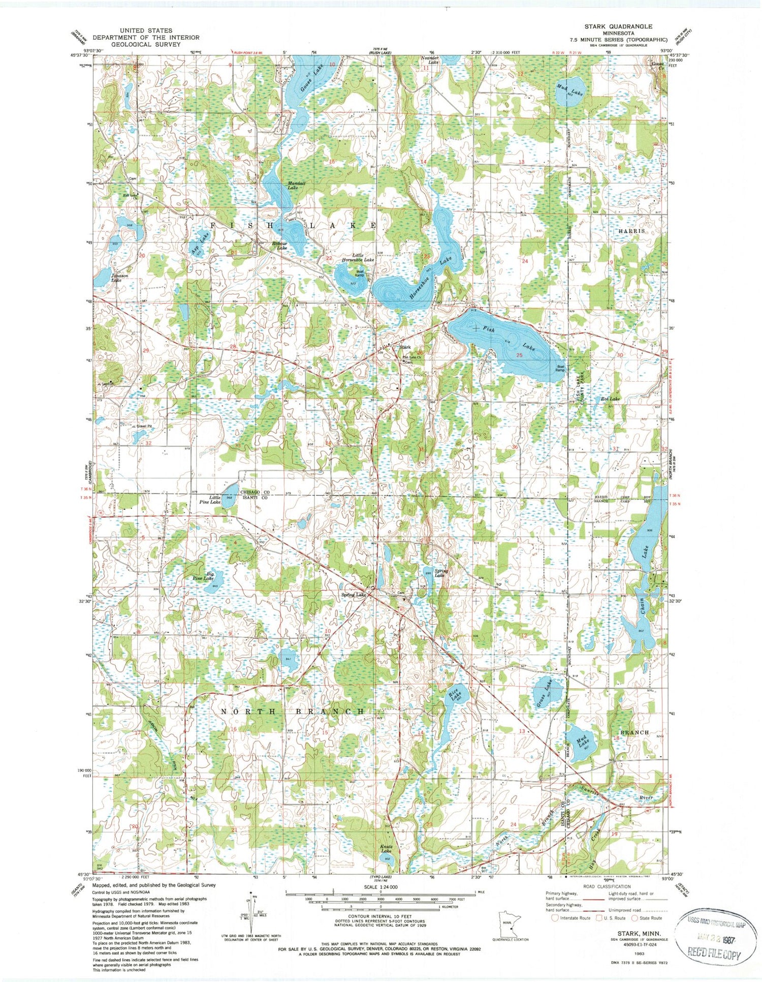
Classic USGS Stark Minnesota 7.5'x7.5' Topo Map
Couldn't load pickup availability
Historical USGS topographic quad map of Stark in the state of Minnesota. Map scale may vary for some years, but is generally around 1:24,000. Print size is approximately 24" x 27"
This quadrangle is in the following counties: Chisago, Isanti.
The map contains contour lines, roads, rivers, towns, and lakes. Printed on high-quality waterproof paper with UV fade-resistant inks, and shipped rolled.
Contains the following named places: Asp Lake, Big Pine Lake, Chain Lake, Dale Evangelical Free Church, Fish Lake, Fish Lake Baptist Church, Fish Lake Church, Fish Lake County Park, Fish Lake Lutheran Cemetery, Grass Lake, Harris Apostolic Gospel Church, Horseshoe Lake, Jonason Lake, Judicial Ditch Number Four, Knute Lake, Little Horseshoe Lake, Little Pine Lake, Mandall Lake, Mud Lake, Oak Leaf Grange Hall, Rat Lake, Rice Lake, Robour Lake, Spring Lake, Spring Lake Census Designated Place, Spring Lake Lutheran Cemetery, Spring Lake Lutheran Church, Spring Lake Post Office, Stark, Stark Post Office, Township of Fish Lake, Township of North Branch, Trulson Wildlife Pond Dam


