MyTopo
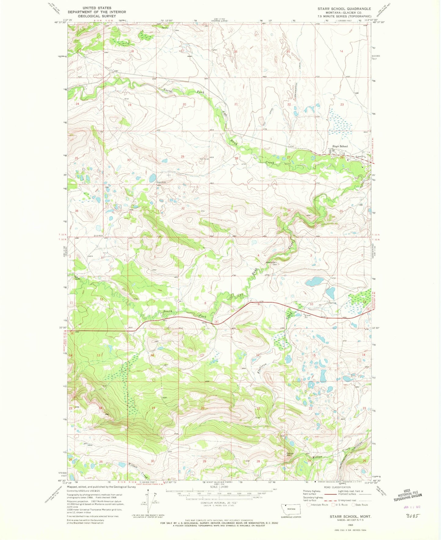
Classic USGS Starr School Montana 7.5'x7.5' Topo Map
Couldn't load pickup availability
Historical USGS topographic quad map of Starr School in the state of Montana. Map scale may vary for some years, but is generally around 1:24,000. Print size is approximately 24" x 27"
This quadrangle is in the following counties: Glacier.
The map contains contour lines, roads, rivers, towns, and lakes. Printed on high-quality waterproof paper with UV fade-resistant inks, and shipped rolled.
Contains the following named places: 33N12W25BBCC01 Well, 33N12W25BCBC01 Well, 33N12W25CBBC01 Spring, Afterbuffalo Cemetery, Aspenwood Camp, North Fork Cut Bank Creek, Sacred Heart Mission, South Fork Cut Bank Creek, Star, Starr Baptist Church, Starr Elementary School, Starr School, Starr School Census Designated Place