MyTopo
Classic USGS Starrucca Pennsylvania 7.5'x7.5' Topo Map
Couldn't load pickup availability
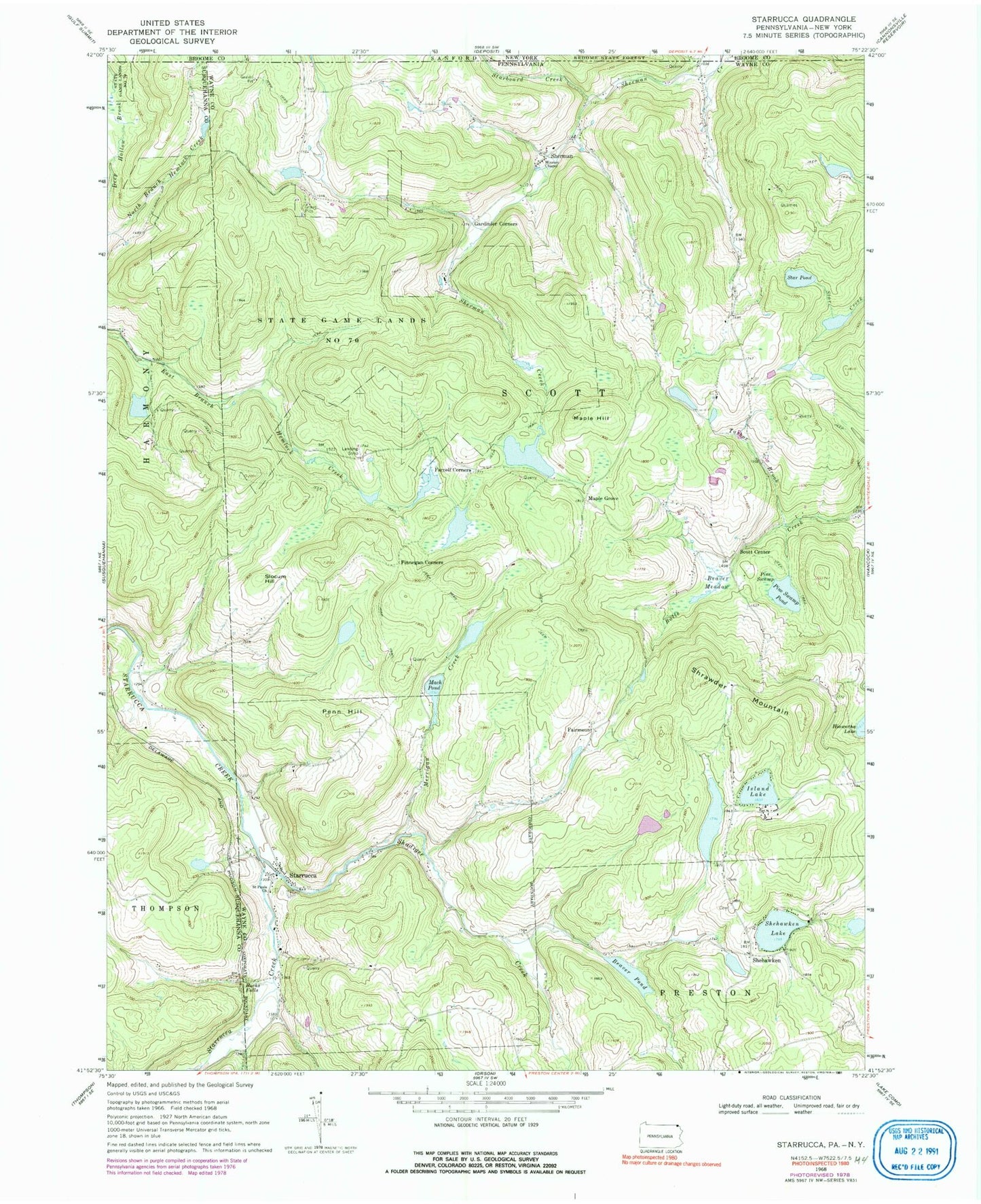
Historical USGS topographic quad map of Starrucca in the states of Pennsylvania, New York. Typical map scale is 1:24,000, but may vary for certain years, if available. Print size: 24" x 27"
This quadrangle is in the following counties: Broome, Susquehanna, Wayne.
The map contains contour lines, roads, rivers, towns, and lakes. Printed on high-quality waterproof paper with UV fade-resistant inks, and shipped rolled.
Contains the following named places: Beaver Meadow, Beaver Pond, Bucks Falls, Farrell Corners, Finnegan Corners, Gardinier Corners, Island Lake, Mach Pond, Maple Hill, Merrigan Creek, Mission Chapel, Penn Hill, Pine Swamp, Pine Swamp Pond, Saint Pauls Church, Shadigee Creek, Shehawken, Shehawken Lake, Sherman, Shrawder Mountain, Slocum Hill, Star Pond, Starrucca, State Game Lands Number 70, Tarbox Brook, Beaver Pond Dam, Shehawken Dam, Fairmont School (historical), King Hill School, Shehawken School, Fairmount, Maple Grove, Scott Center, State Game Lands Number 299, Starrucca Station, Island Pond, Borough of Starrucca, Township of Scott, Starrucca Post Office, Cat Hollow, Starboard Creek