
MyTopo
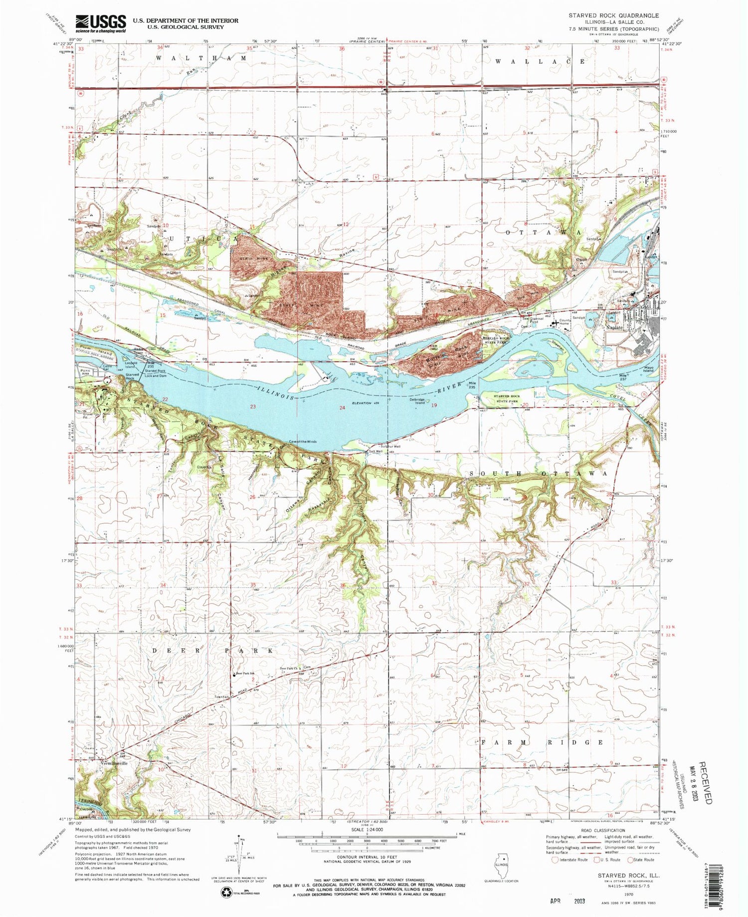
Classic USGS Starved Rock Illinois 7.5'x7.5' Topo Map
Couldn't load pickup availability
Historical USGS topographic quad map of Starved Rock in the state of Illinois. Typical map scale is 1:24,000, but may vary for certain years, if available. Print size: 24" x 27"
This quadrangle is in the following counties: LaSalle.
The map contains contour lines, roads, rivers, towns, and lakes. Printed on high-quality waterproof paper with UV fade-resistant inks, and shipped rolled.
Contains the following named places: Buffalo Rock, Buffalo Rock State Park, Clark Run, Covel Creek, Deer Park Church, Deer Park Community Consolidated Elementary School, Delbridge Island, French Canyon, Hennepin Canyon, Higbee Ravine, Horseshoe Canyon, Illinois Canyon, Kaskaskia Canyon, LaSalle Canyon, Leopold Island, Naplate, Ottawa Canyon, Plum Island, Sheehan Island, Starved Rock, Starved Rock Lock and Dam, Starved Rock State Park, Tonti Canyon, Vermilionville, Wildcat Canyon, LaSalle County, WWTO-TV (La Salle), Township of Deer Park, Township of Ottawa, Township of Utica, Starved Rock Pool, Chautaugua Grounds (historical), Bell Rose (historical), Twin Bluffs (historical), Lock Number 12 (historical), Diehl School (historical), Hodgson School (historical), Armstrong School (historical), Browns School (historical), Kenny School (historical), Fishburn School (historical), Strawn School (historical), Esmond School (historical), Hickory College (historical), Dimmick School (historical), Bunker Hill School (historical), Starved Rock Airpark (historical), Aurora Canyon, Eagle Cliff Overlook, Fort Saint Louis (historical), George P Hill Public School, Horseshoe Bend, La Salle County Home, Lovers Leap Overlook, Owl Canyon, Parkmans Plain, Vermillionville Cemetery, Utica Quarry, Buffalo Rock Mine (historical), Osage Mine (historical), Village of Naplate, Naplate Fire Department


