MyTopo
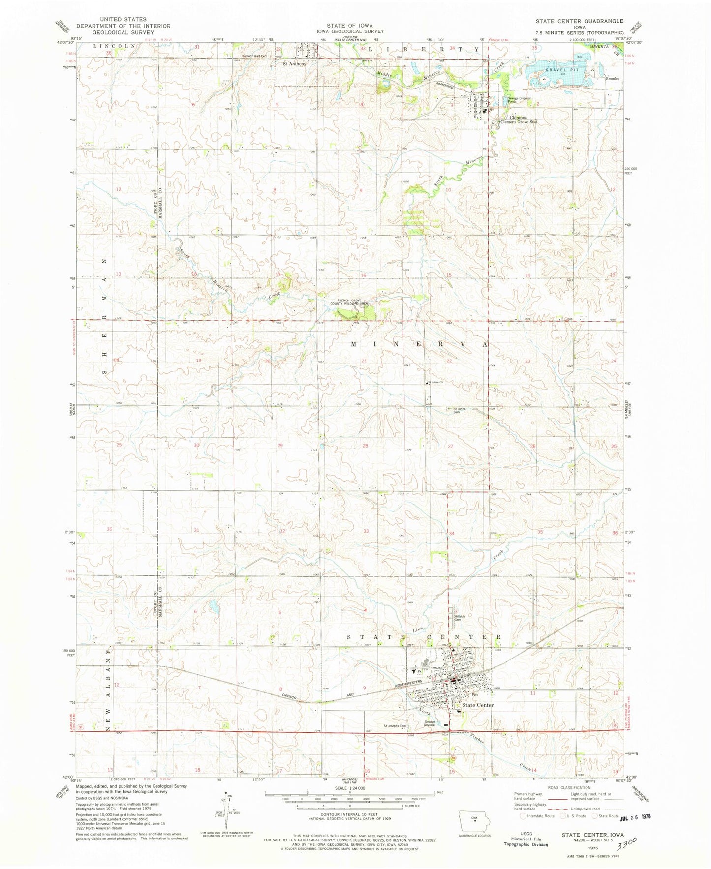
Classic USGS State Center Iowa 7.5'x7.5' Topo Map
Couldn't load pickup availability
Historical USGS topographic quad map of State Center in the state of Iowa. Map scale may vary for some years, but is generally around 1:24,000. Print size is approximately 24" x 27"
This quadrangle is in the following counties: Marshall, Story.
The map contains contour lines, roads, rivers, towns, and lakes. Printed on high-quality waterproof paper with UV fade-resistant inks, and shipped rolled.
Contains the following named places: Bromley, Bromley Post Office, City of Clemons, City of Saint Anthony, City of State Center, Clemons, Clemons Cemetery, Clemons Fire Department, Clemons Lutheran School, Clemons Post Office, Clemons United Church of Christ, Congregational Christian Church, First United Presbyterian Church, French Grove County Wildlife Area, Gutekunst Public Library, Hillside Cemetery, Mackin Grain Company Elevator, McFarland Clinic, Middle Minerva Creek, Mid-Iowa Co-op Elevator, Minerva Post Office, Rose Capital Mini Mall, Sacred Heart Catholic Church, Sacred Hearts Cemetery, Saint Anthony, Saint Johns Cemetery, Saint Johns Church, Saint Josephs Cemetery, Saint Paul's Lutheran Church, State Center, State Center Fire and Emergency Services, State Center Manor, State Center Post Office, State Center Rose Garden, Township of Minerva, Trinity Lutheran Church, United Methodist Church, West Marshall Elementary School, West Marshall High School, West Marshall Middle School, ZIP Code: 50247