MyTopo
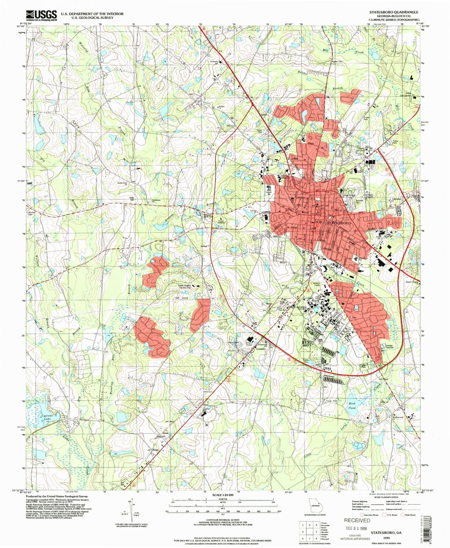
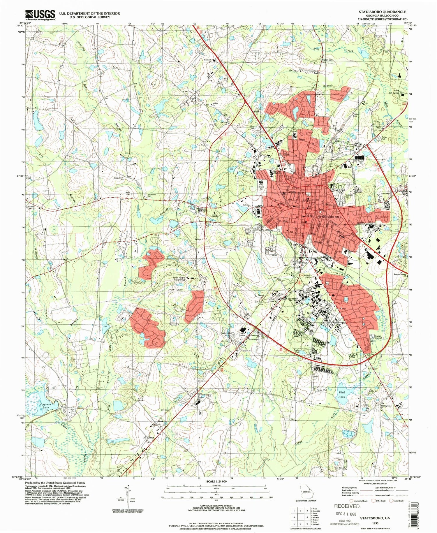
Classic USGS Statesboro Georgia 7.5'x7.5' Topo Map
Couldn't load pickup availability
Historical USGS topographic quad map of Statesboro in the state of Georgia. Map scale may vary for some years, but is generally around 1:24,000. Print size is approximately 24" x 27"
This quadrangle is in the following counties: Bulloch.
The map contains contour lines, roads, rivers, towns, and lakes. Printed on high-quality waterproof paper with UV fade-resistant inks, and shipped rolled.
Contains the following named places: Abundant Life Worship Center, Akins Cemetery, Altman Pond, Altman Pond Dam, Anderson Hall, Arena Park, Belair Estates, Belcher Branch, Bethel Church, Bethlehem Church, Bethlehem Primitive Baptist Church Cemetery, Bird Mobile Home Park, Bird Pond, Blitch State Park, Brannen Cemetery, Brannen Hall, Brannens Chapel Methodist Episcopal Church, Bryant School, Bulloch Academy, Bulloch County Correctional Institution, Bulloch County Courthouse, Bulloch County Health Center, Bulloch County Sheriff's Office, Bulloch County Sherriff's Office, Bulloch Memorial Hospital, Bulloch Plaza Shopping Center, Calvary Baptist Church, Camp Cliff Cannon, Carroll Building, Carruth Building, Central High School, Charles H Herty Pines Nature Preserve, City of Statesboro, Colfax, College Plaza Shopping Center, Cone Hall, Country Club Estates, Country Club Hills, Country Squire, Cypress Lake, Cypress Lake Dam, Deal Branch, Deal Cemetery, Deal Hall, Deerfield, Dorman Hall, Dry Branch, Eagle Court, East Georgia Regional Medical Center, East Main Street Commercial Historic District, Eastern Heights Church, Eastside Cemetery, Edgewood Acres, Fair Road Park, Fielding D Russell Union, First African Baptist Church, First Assembly of God Church, First Baptist Church, First Methodist Church, First Presbyterian Church, Fletcher Memorial Baptist Church, Forest Drive Classroom Building, Forest Heights, Forest Heights Country Club, Forest Hills, Foxlake, Foy Fine Arts Building, Gentilly Square Shopping Center, Georgia Southern, Georgia Southern Contract Postal Unit, Georgia Southern University, Georgia State Patrol Troop F Post 45, Georgian Walk, Gracewood Church, Granna Branch, Greater Bethel Church, Greenbriar, Greenhaven Mobile Home Park, Greenwood, H Z Smith Lake, H Z Smith Lake Dam, Hampton Hall, Hanner Fieldhouse, Hanner Tennis Courts, Hazelwood, Henderson Library, Hendricks Hall, Heritage Inn of Statesboro Nursing Home, Hillside Mobile Home Park, Historical First African Church, Hodges Church, Hood Pond, Hood Pond Dam, Horseshoe Bend, Huntington, Inglewood, Institute of Arthropodology and Parasitology, Irongate, J I Clements Stadium, James Junior High School, Jimps, Johnson Hall, Johnsons Mobile Court, Kennedy School, Kingswood, Lake Ruby, Lake Wells, Lakeview Estates, Landrum Center, Langston Church, Langston Church Cemetery, Langston United Methodist Church, Lewis Hall, Lively School, Love School, Lynn Haven Estates, Mallard Pond, Mallard Pond Dam, Marvin Pittman Elementary School, Marvin Pittman Gymnasium, McCroan Auditorium, Middleground Church, Newton Building, North College Street Residential Historic District, North Main Street Commercial Historic District, Northlake, Northpoint Mobile Home Park, Northside School, Northwood, Oakcrest, Olde Towne, Olewine Park, Olliff Hall, Oxford Hall, Pate Place, Paulson Stadium, Pine Cove, Pine Forest, Pine Needle Hills, Pinelawn Memorial Park, Pittman Park Church, Quail Run, Ramblewood East, Rigdon Cemetery, Riggs Lake, Riggs Lake Dam, Riggs Old Mill, Riggs Pond, Riggs Pond Dam, Robinson Pond, Rosenwald Building, Saddlecreek, Saint Matthews Church, Saint Paul Church, Sanford Hall, Sherwood Forest, Simmons Shopping Center, Smith Allen Deal School, Smith Grove Church, Smith Lake, Smith Lake Dam, Somerset, South Building, South Main Street Commercial Historic District, South Main Street Residential Historic District, Southern Center for Continuing Education, Stadium Club, Stadium Walk, Statesboro, Statesboro Academy, Statesboro City Hall, Statesboro City Police Department, Statesboro Division, Statesboro East Main Church, Statesboro Fire Department Station 1, Statesboro Fire Department Station 2, Statesboro High School, Statesboro Institute, Statesboro Mall Shopping Center, Statesboro New Covenant Church, Statesboro Post Office, Statesboro Primitive Baptist Church, Statesboro Regional Library, Statesboro Square Shopping Center, Statesboro Water Pollution Control Plant, Stratford Hall, Sunnyside School, Sussex Commons, Sweatheart Circle, Tabernacle Baptist Church, The Eagle Shopping Center, The Plaza Knight Village Shopping Center, Thomas Grove Church, Tryon School, Veazy Hall, W Jones Lane Memorial Park, Watering Hole Branch, West Main Street Commercial Historic District, Westbrooke, Westchester, Westside Church, Westwood Nursing Center, Williams Center, Williams Grove Church of God, Willingway Hospital, Winburn Hall, WMCD-FM (Statesboro), Wolf Pen Mobile Home Park, Wolfpen Branch, Woodland Mobile Estates, Woodlawn Terrace, WPTB-AM (Statesboro), WUUF-FM (Statesboro), WVGS-FM (Statesboro), WWNS-AM (Statesboro), Zetterower School, ZIP Codes: 30458, 30460


