MyTopo
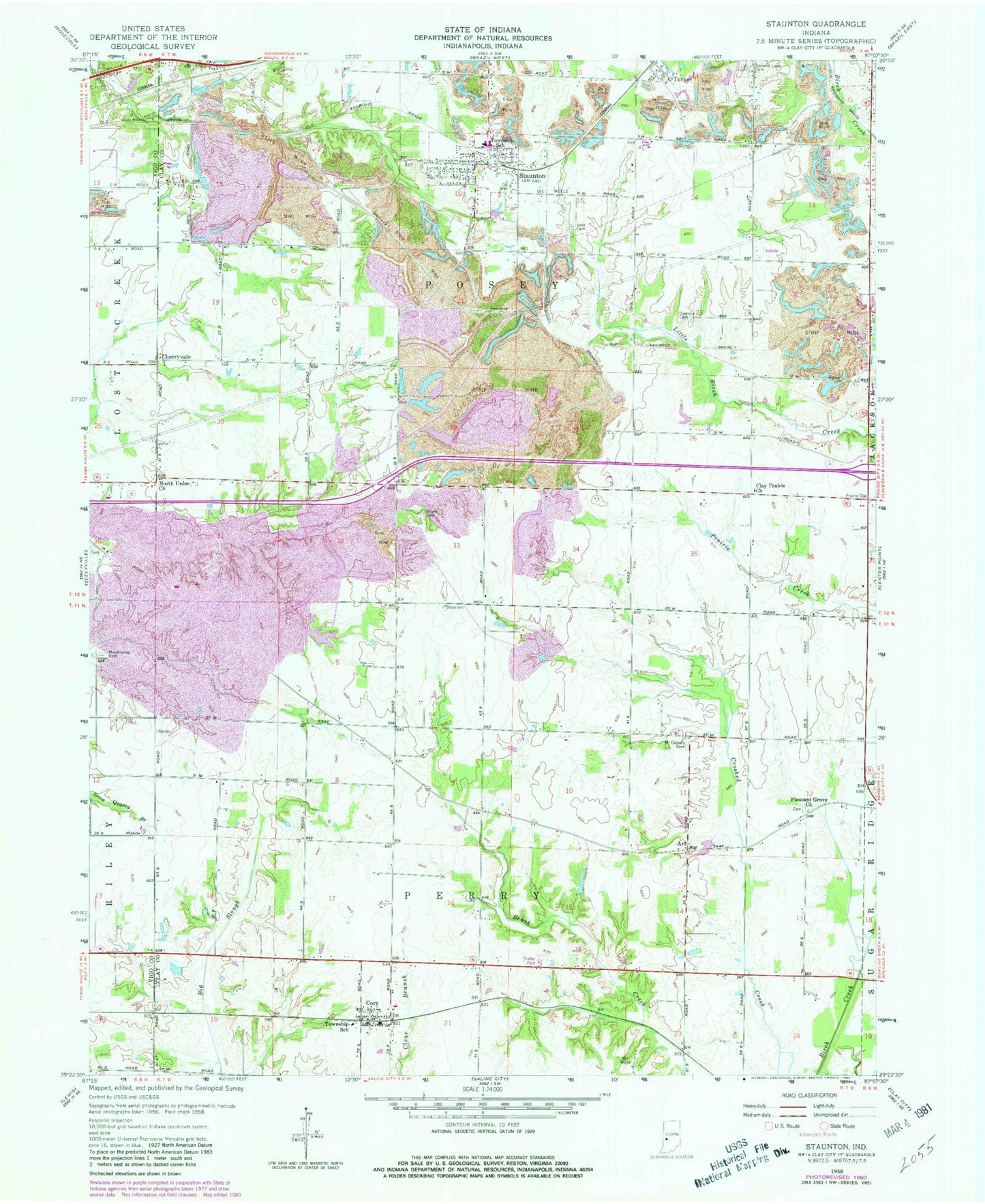
Classic USGS Staunton Indiana 7.5'x7.5' Topo Map
Couldn't load pickup availability
Historical USGS topographic quad map of Staunton in the state of Indiana. Map scale may vary for some years, but is generally around 1:24,000. Print size is approximately 24" x 27"
This quadrangle is in the following counties: Clay, Vigo.
The map contains contour lines, roads, rivers, towns, and lakes. Printed on high-quality waterproof paper with UV fade-resistant inks, and shipped rolled.
Contains the following named places: Art, Cherryvale, Clay Prairie, Clay Prairie Church, Cory, Cory Post Office, Cory Volunteer Fire Department, German Cemetery, Mewhinney Cemetery, Mount Calvary Cemetery, North Union Church, Pleasant Grove Church, Posey Township Clay County Volunteer Fire Department, Rhule Cemetery, Staunton, Staunton Elementary School, Staunton High School, Staunton Post Office, Summit Lawn Cemetery, Town of Staunton, Township of Perry, Township of Posey, Turner, Wheeler Prairie, ZIP Codes: 47846, 47881