
MyTopo
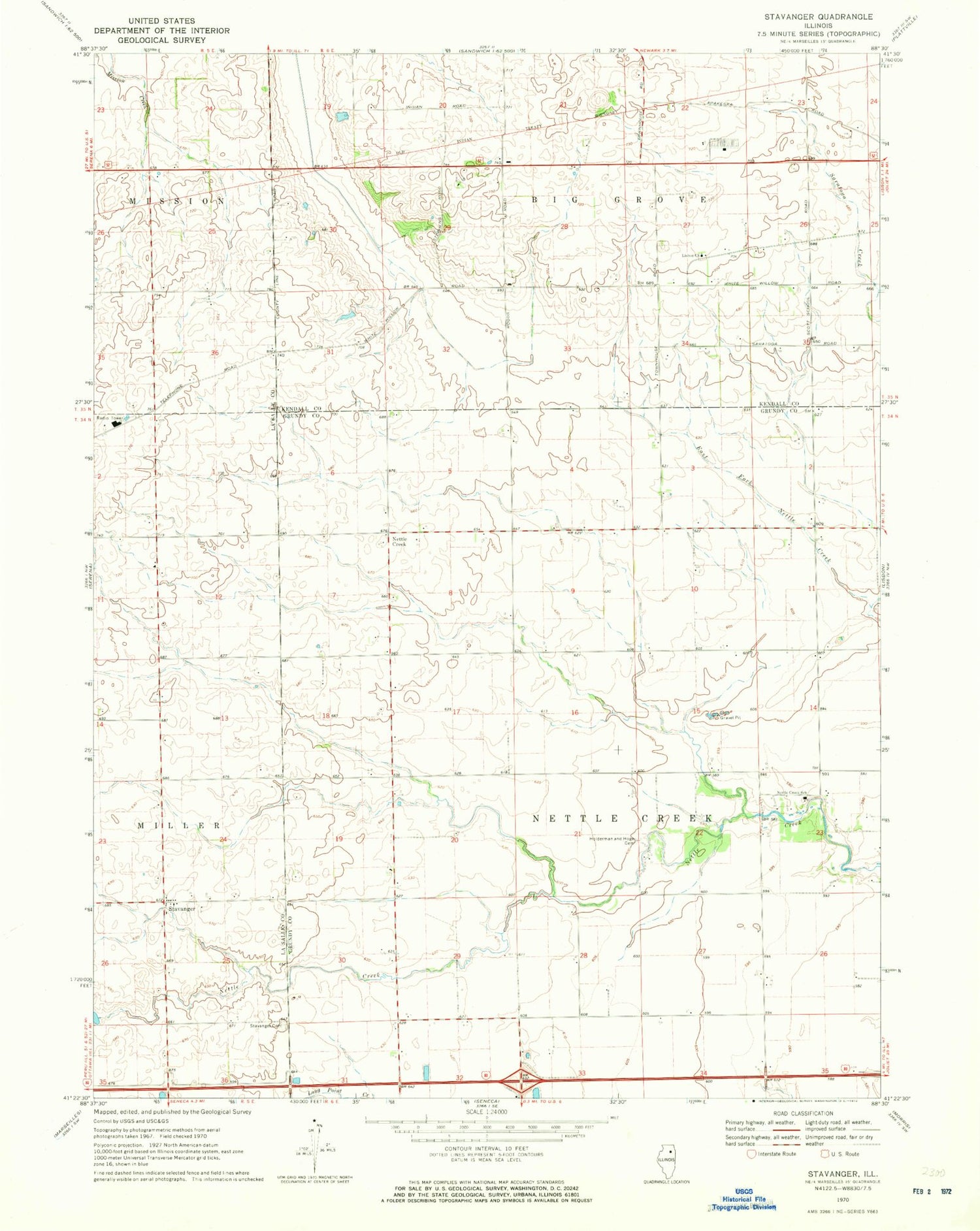
Classic USGS Stavanger Illinois 7.5'x7.5' Topo Map
Couldn't load pickup availability
Historical USGS topographic quad map of Stavanger in the state of Illinois. Map scale may vary for some years, but is generally around 1:24,000. Print size is approximately 24" x 27"
This quadrangle is in the following counties: Grundy, Kendall, LaSalle.
The map contains contour lines, roads, rivers, towns, and lakes. Printed on high-quality waterproof paper with UV fade-resistant inks, and shipped rolled.
Contains the following named places: Apakeska Grove, Brown School, Cassem School, Collins Grove, Dix School, Forbes School, Gray School, Hoge School, Holderman and Hoge Cemetery, Holdermans Grove, Kelloggs Grove, Long Point Creek, Morey School, Mount Pleasant School, Naden School, Ness School, Nettle Creek, Nettle Creek Elementary School, Nettle Creek Landings, Sampson School, Scott School, Stavanger, Stavanger Cemetery, Stavanger Lutheran Church, Stephens School, Township of Nettle Creek, Vogen RLA Airport, West Lisbon Lutheran Cemetery, West Lisbon Lutheran Church


