MyTopo
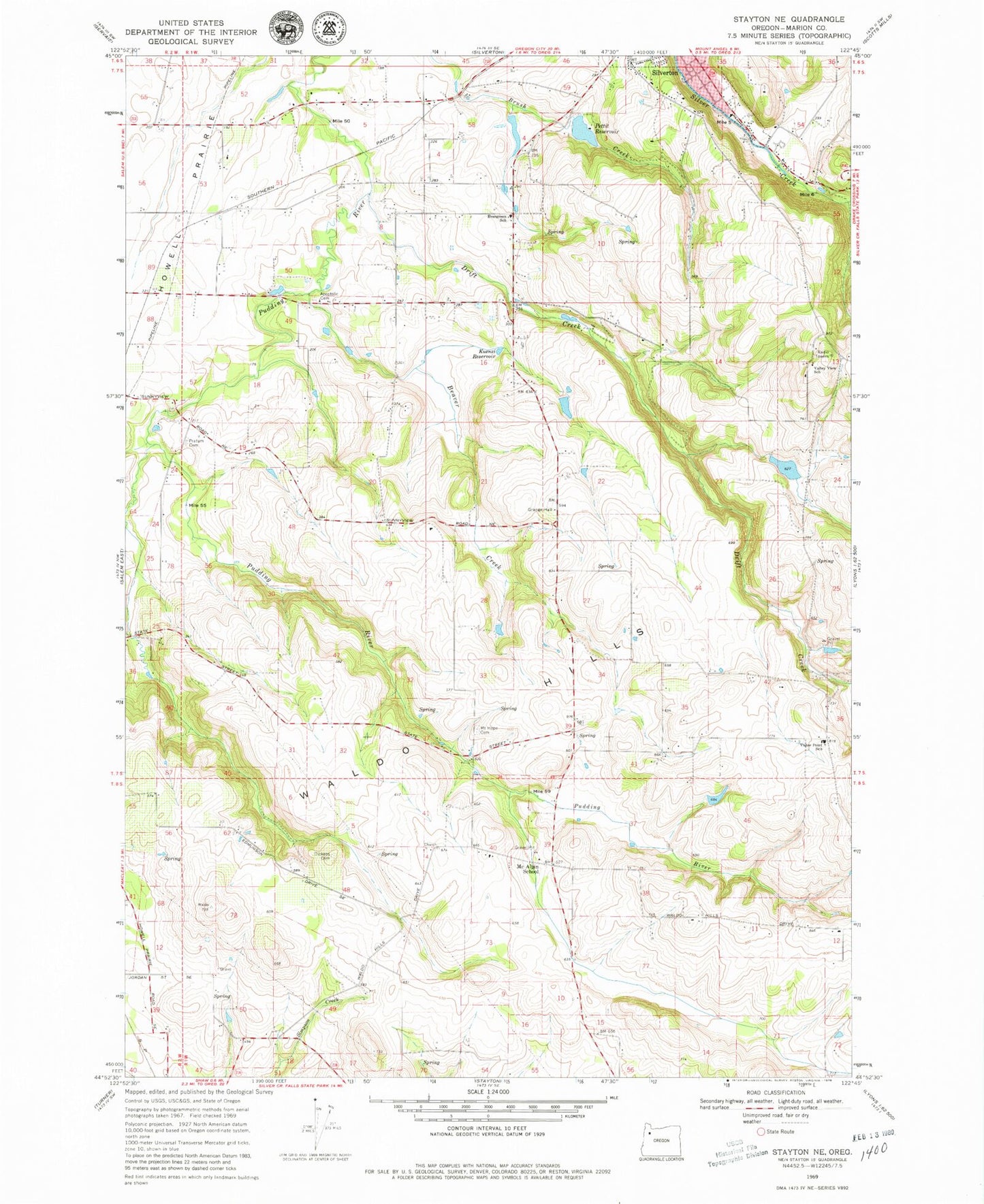
Classic USGS Stayton NE Oregon 7.5'x7.5' Topo Map
Couldn't load pickup availability
Historical USGS topographic quad map of Stayton NE in the state of Oregon. Map scale may vary for some years, but is generally around 1:24,000. Print size is approximately 24" x 27"
This quadrangle is in the following counties: Marion.
The map contains contour lines, roads, rivers, towns, and lakes. Printed on high-quality waterproof paper with UV fade-resistant inks, and shipped rolled.
Contains the following named places: Apostolic Cemetery, Barnes Brothers Reservoir, Barnes Brothers Reservoir Dam, Beaver Creek, Beaver Creek Reservoir, Bye Reservoir, Campbell Reservoir, Clymer, Clymer Post Office, Dickens Cemetery, Drift Creek, Evergreen Elementary School, Funrue Dam, Funrue Reservoir, Grier Reservoir, Howell Prairie, Hunegs Reservoir, Iron Crown Airport, Johnsons Mill, Kimsey - Walker Cemetery, Kuenzi Reservoir, Lebanon Post Office, Lorence Dam, Lorence Reservoir, McAlpin School, Millford, Mount Hope Cemetery, Oregon Garden Amphitheatre, Pettit Dam, Pettit Reservoir, Pratum Cemetery, Quigley Reservoir, Rogers Wayside County Park, S M S Dam Number 1, S M S Reservoir Number One, Scandia, Schmid Reservoir, Selah, Silver Creek Post Office, Silverton Rural Fire Protection District Victor Point Station 2, South Fork Pudding River, Spady Reservoir, Stadeli Reservoir, Switzerland, Switzerland Post Office, Urban Reservoir, Valley View Reservoir, Valley View School, Victor Point Elementary School, Waldo Hills, Waldo Hills Grange Hall, Willard, Willard Post Office, Wright Sump