
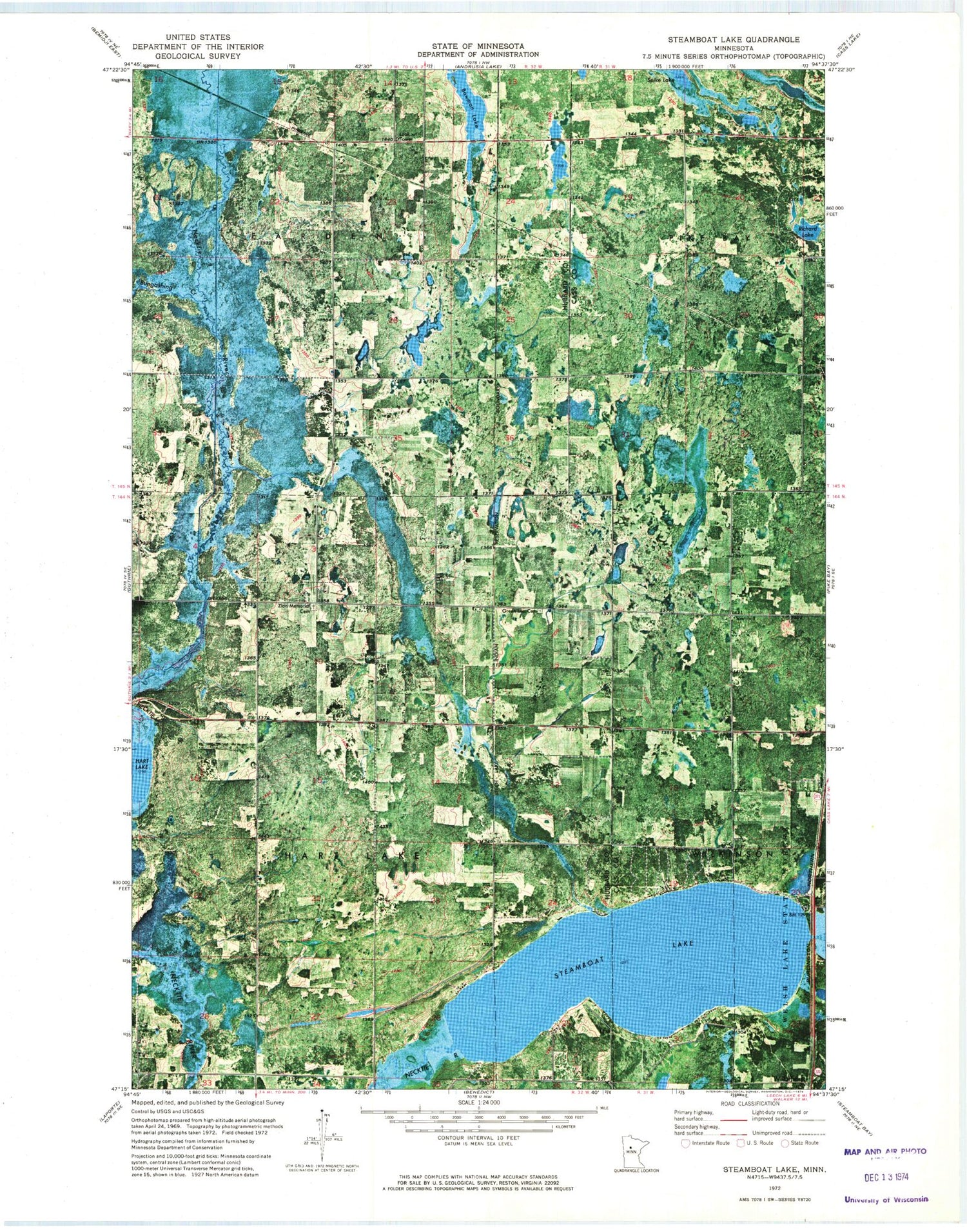
MyTopo
Classic USGS Steamboat Lake Minnesota 7.5'x7.5' Topo Map
Regular price
$16.95
Regular price
Sale price
$16.95
Unit price
per
Couldn't load pickup availability
Historical USGS topographic quad map of Steamboat Lake in the state of Minnesota. Map scale may vary for some years, but is generally around 1:24,000. Print size is approximately 24" x 27"
This quadrangle is in the following counties: Cass, Hubbard.
The map contains contour lines, roads, rivers, towns, and lakes. Printed on high-quality waterproof paper with UV fade-resistant inks, and shipped rolled.
Contains the following named places: Ben Israel Fellowship, Bowman Lake, Bungashing Creek, Green Lea Cemetery, Necktie River, Raboin, Raboin Post Office, Richard Lake, Spike Lake, Steamboat Lake, Township of Farden, Township of Hart Lake, Wilkinson, Wilkinson Post Office, Zion Memorial Cemetery


