MyTopo
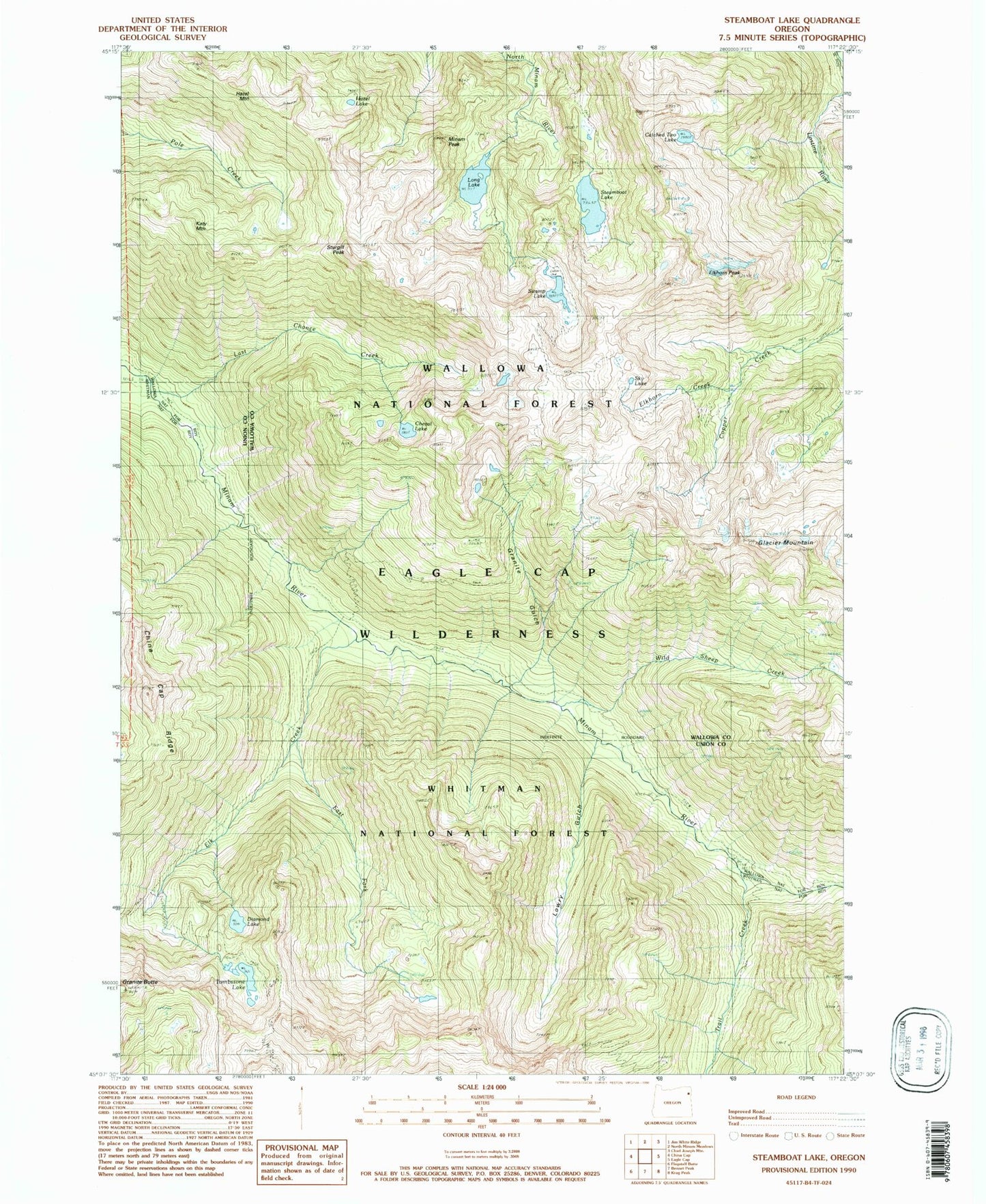
USGS Classic Steamboat Lake Oregon 7.5'x7.5' Topo Map
Couldn't load pickup availability
Historical USGS topographic quad map of Steamboat Lake in the state of Oregon. Scale: 1:24000. Print size: 24" x 27"
This quadrangle is in the following counties: Union, Wallowa.
The map contains contour lines, roads, rivers, towns, lakes, and grids including latitude / longitude and UTM / MGRS. Printed on high-quality waterproof paper with UV fade-resistant inks.
Contains the following named places: Catched Two Lake, Cheval Lake, Copper Creek Trail, Diamond Lake, East Fork Elk Creek, Elk Creek, Elkhorn Creek, Elkhorn Peak, Glacier Mountain, Granite Gulch, Hazel Lake, Hazel Mountain, Katy Mountain, Last Chance Creek, Long Lake, Lowry Gulch, Minam Peak, Steamboat Lake, Sturgill Peak, Swamp Lake, Tombstone Lake, Trail Creek, Wild Sheep Creek, Sky Lake, Eagle Cap Wilderness