
MyTopo
Classic USGS Steamboat Mountain Utah 7.5'x7.5' Topo Map
Regular price
$16.95
Regular price
Sale price
$16.95
Unit price
per
Couldn't load pickup availability
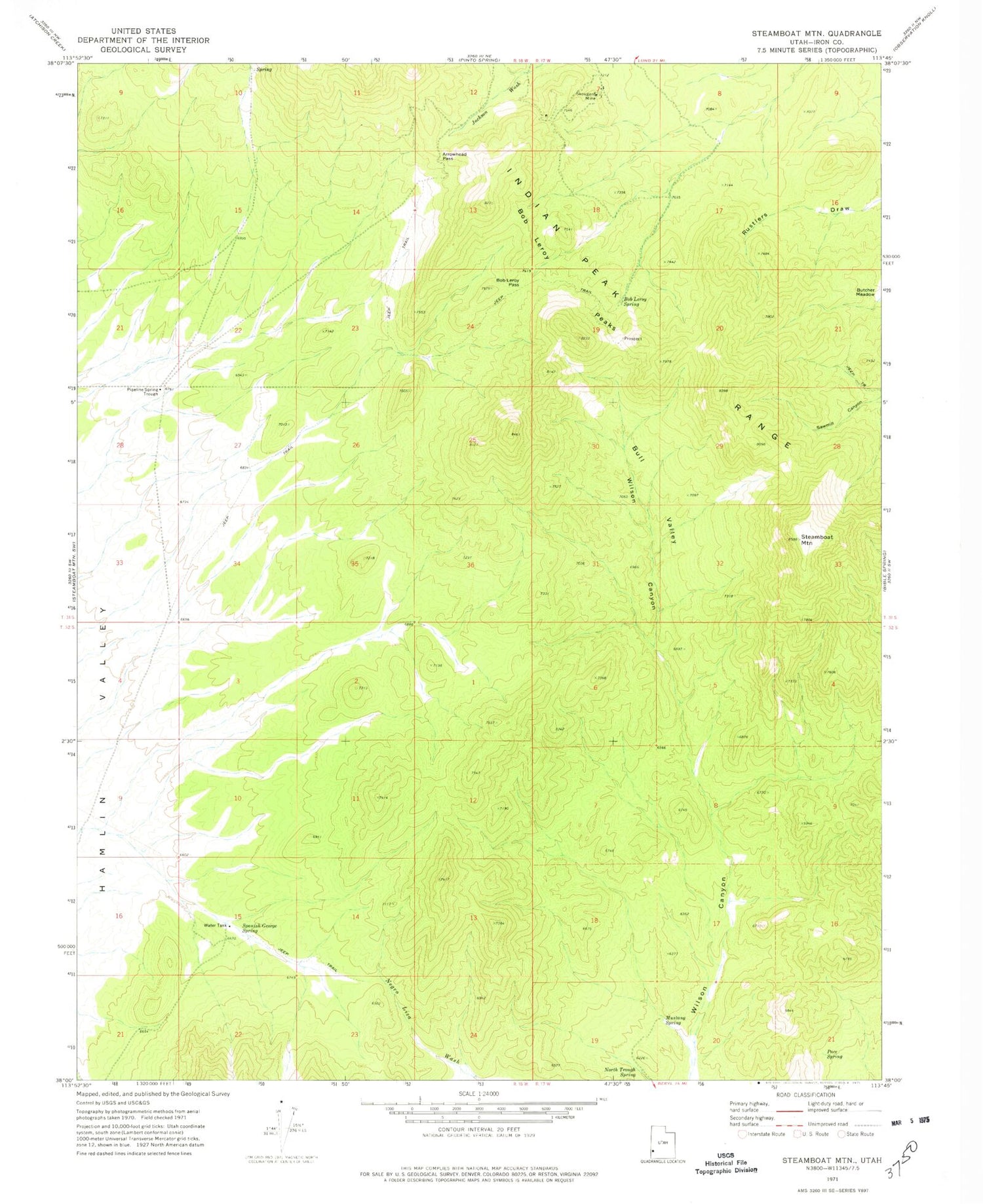
Historical USGS topographic quad map of Steamboat Mountain in the state of Utah. Map scale may vary for some years, but is generally around 1:24,000. Print size is approximately 24" x 27"
This quadrangle is in the following counties: Iron.
The map contains contour lines, roads, rivers, towns, and lakes. Printed on high-quality waterproof paper with UV fade-resistant inks, and shipped rolled.
Contains the following named places: Arrowhead Pass, Bob Leroy Pass, Bob Leroy Peaks, Bob Leroy Spring, Bull Valley, Mustang Spring, North Trough Spring, Pace Spring, Pipeline Spring Trough, Skougard Mine, Spanish George Spring, Steamboat Mountain


