MyTopo
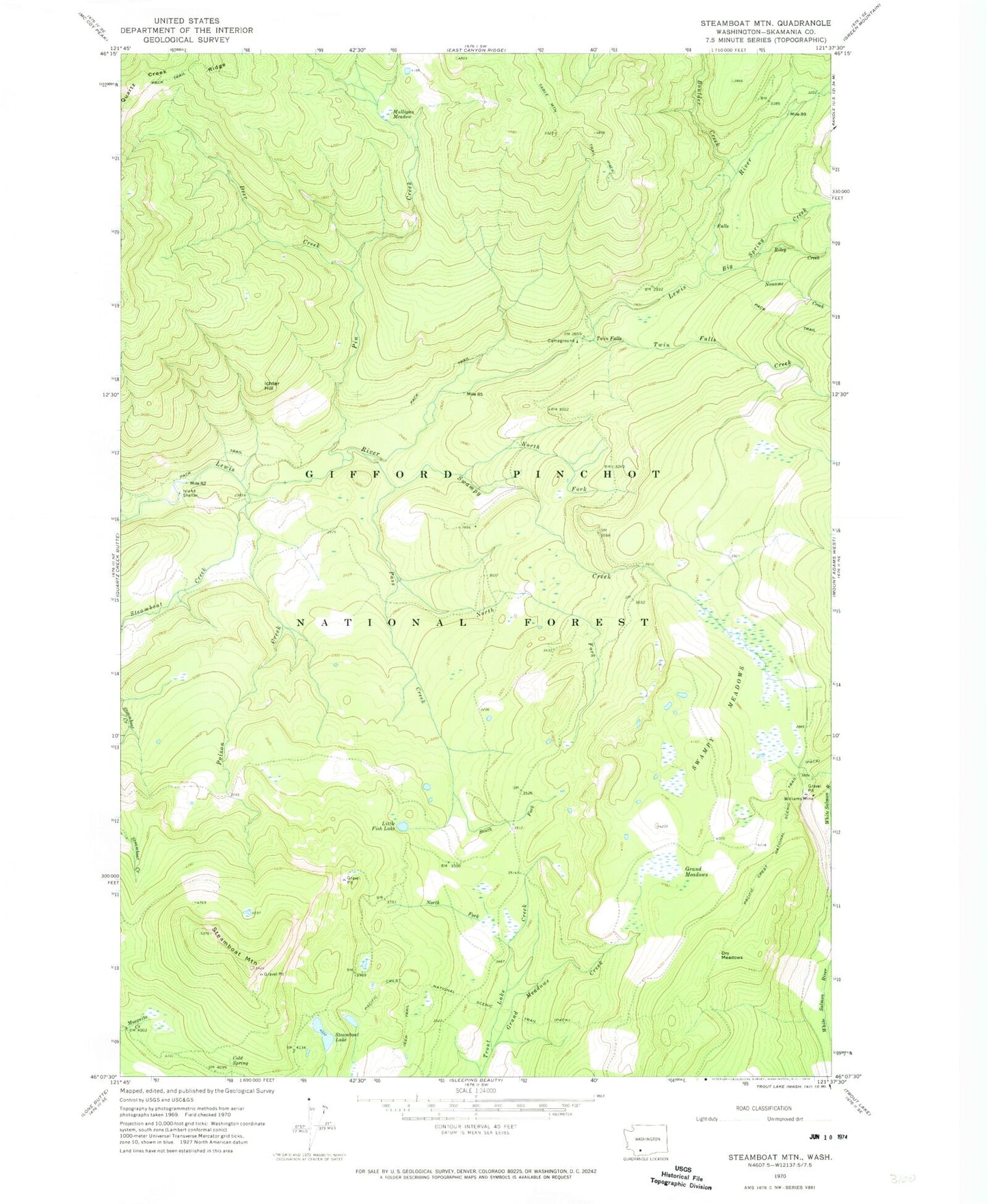
Classic USGS Steamboat Mountain Washington 7.5'x7.5' Topo Map
Couldn't load pickup availability
Historical USGS topographic quad map of Steamboat Mountain in the state of Washington. Typical map scale is 1:24,000, but may vary for certain years, if available. Print size: 24" x 27"
This quadrangle is in the following counties: Skamania.
The map contains contour lines, roads, rivers, towns, and lakes. Printed on high-quality waterproof paper with UV fade-resistant inks, and shipped rolled.
Contains the following named places: Big Spring Creek, Boulder Creek, Cold Spring, Deer Creek, Dry Meadows, Grand Meadows, Grand Meadows Creek, Ichter Hill, Island Shelter, Little Fish Lake, Mulligan Meadow, Noname Creek, North Fork Pass Creek, North Fork Swampy Creek, North Fork Trout Lake Creek, Pass Creek, Pin Creek, Poison Creek, Riley Creek, South Fork Pass Creek, Steamboat Creek, Steamboat Lake, Steamboat Mountain, Swampy Creek, Swampy Meadows, Table Mountain Trail, Twin Falls, Twin Falls Creek, Williams Mine, Steamboat Lake Campground, Steamboat Mountain Research Natural Area, Twin Falls Campground