MyTopo
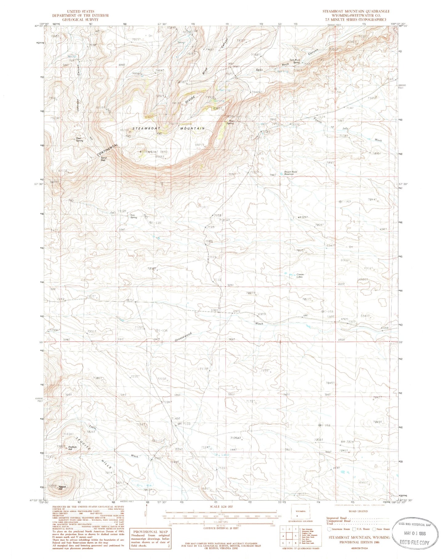
Classic USGS Steamboat Mountain Wyoming 7.5'x7.5' Topo Map
Regular price
$16.95
Regular price
Sale price
$16.95
Unit price
per
Couldn't load pickup availability
Historical USGS topographic quad map of Steamboat Mountain in the state of Wyoming. Map scale may vary for some years, but is generally around 1:24,000. Print size is approximately 24" x 27"
This quadrangle is in the following counties: Sweetwater.
The map contains contour lines, roads, rivers, towns, and lakes. Printed on high-quality waterproof paper with UV fade-resistant inks, and shipped rolled.
Contains the following named places: Brown Rock Reservoir, Carson Lakes, Chilton Ranch, Deer Spring, Endlich Hill, Hague Hill, Iron Spring, Johnson Ranch, Pine Spring, Rock Springs North Division, Sand Gap, Split Rock Spring, Steamboat Mountain