MyTopo
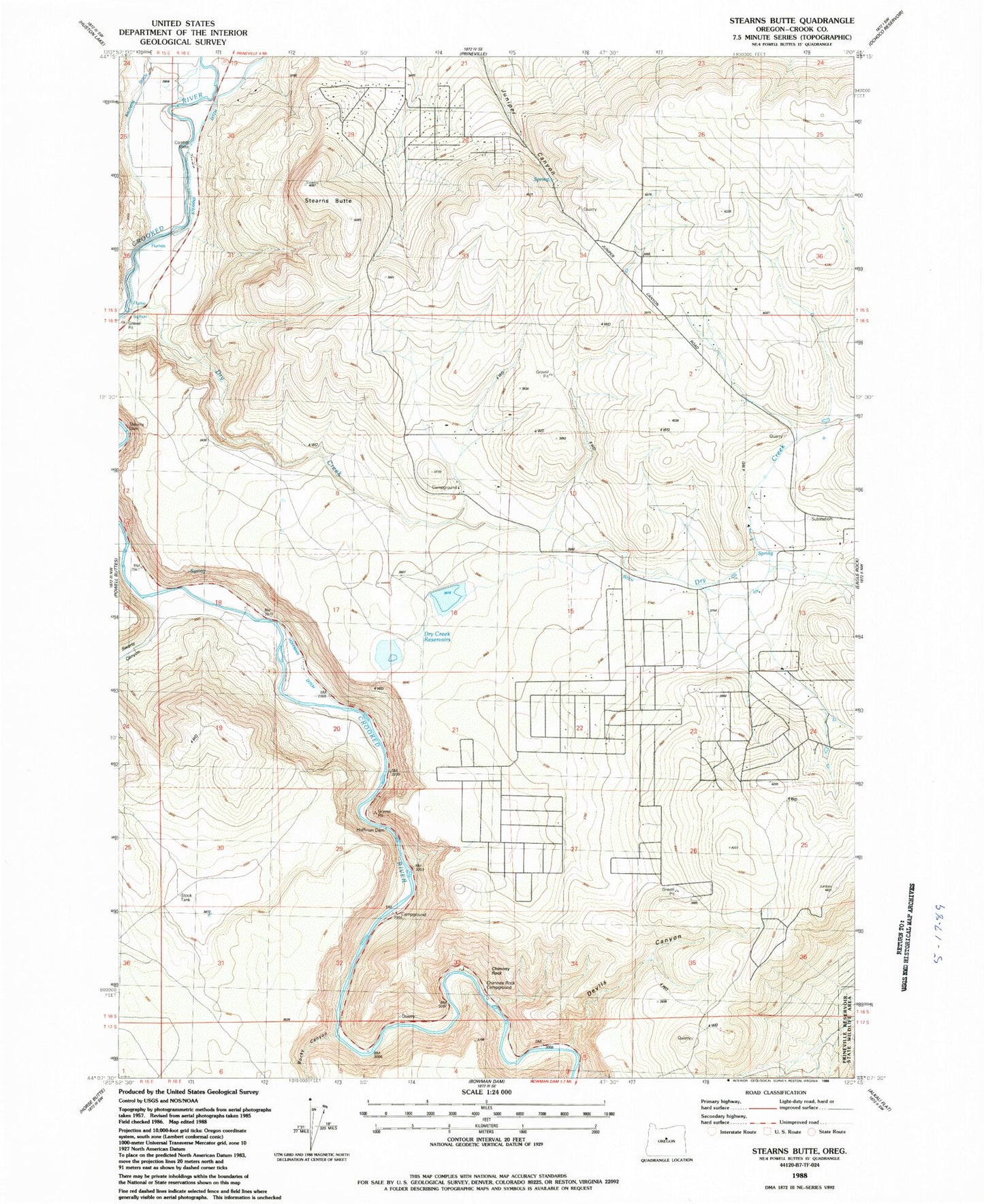
Classic USGS Stearns Butte Oregon 7.5'x7.5' Topo Map
Couldn't load pickup availability
Historical USGS topographic quad map of Stearns Butte in the state of Oregon. Map scale may vary for some years, but is generally around 1:24,000. Print size is approximately 24" x 27"
This quadrangle is in the following counties: Crook.
The map contains contour lines, roads, rivers, towns, and lakes. Printed on high-quality waterproof paper with UV fade-resistant inks, and shipped rolled.
Contains the following named places: Baldwin Ditch, Chimney Rock, Chimney Rock Campground, Crook County Fire and Rescue - Juniper Canyon, Devils Canyon, Dry Creek, Dry Creek Airpark, Dry Creek Number Two Dam, Dry Creek Number Two Reservoir, Dry Creek Reservoirs, Hoffman Dam, Hoffman Ditch, Juniper Canyon, Juniper Canyon Census Designated Place, Price Spring, Prineville Lake Acres Census Designated Place, Prineville Reservoir County Boat Ramp, Rocky Canyon, Stearns Butte, Stearns Dam, Stearns Ditch, Stearns Ranch, Swartz Canyon