MyTopo
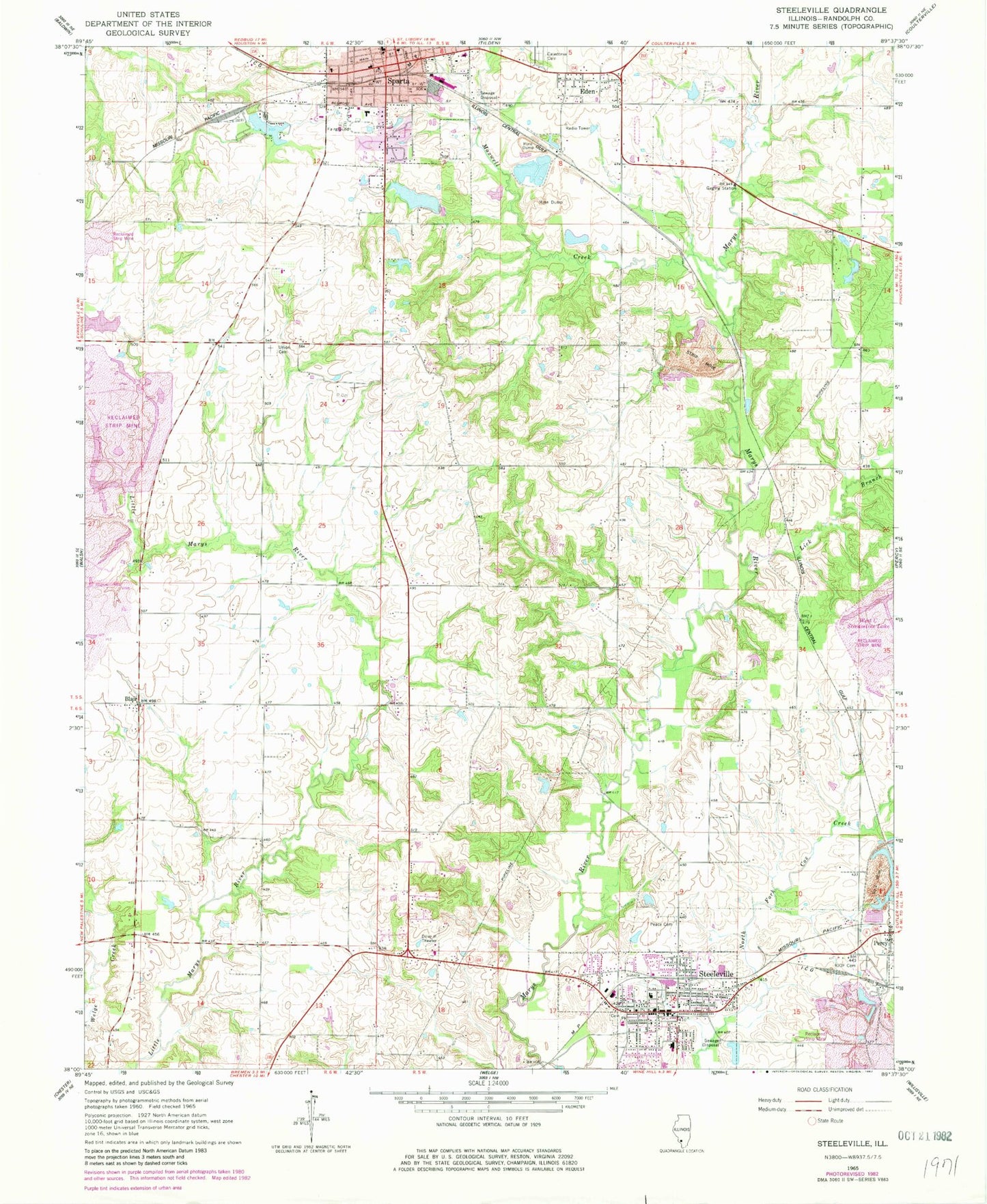
Classic USGS Steeleville Illinois 7.5'x7.5' Topo Map
Couldn't load pickup availability
Historical USGS topographic quad map of Steeleville in the state of Illinois. Map scale may vary for some years, but is generally around 1:24,000. Print size is approximately 24" x 27"
This quadrangle is in the following counties: Randolph.
The map contains contour lines, roads, rivers, towns, and lakes. Printed on high-quality waterproof paper with UV fade-resistant inks, and shipped rolled.
Contains the following named places: Amity School, Blair, Blair Election Precinct, Blair School, Brick School, Brown-Stevenson City Park, Cemetery, Church of the Nazarene, Concord School, Eden, First Baptist Church, First United Methodist Church, Goddard School, Grotto School, Hopewell School, Jollity School, Lick Branch, Mahnken Farms, Maxwell Creek, McClinton School, MedStar Ambulance, Misselhorn Art Museum, New Yale School, Old City Reservoir, Old City Reservoir Dam, Our Lady of Lourdes Roman Catholic Church, Park Estates Mobile Home Park, Peace Lutheran Cemetery, Peace Lutheran Church, Percy Village Cemetery, Saint Marks Lutheran Church, Salem School, Sparta, Sparta Community Hospital, Sparta Country Club, Sparta Election Precinct, Sparta Fire Department Station 1, Sparta Fire Department Station 2, Sparta Historic District, Sparta Police Department, Sparta Post Office, Sparta Public Library, Steeleville, Steeleville Election Precinct, Steeleville Elementary School, Steeleville Fire Department, Steeleville High School, Steeleville Police Department, Steeleville Post Office, Steeleville United Methodist Church, Trinity United Presbyterian Church, Village of Steeleville, Weldon School, WHCO-AM (Sparta), ZIP Code: 62286