MyTopo
Classic USGS Stehekin Washington 7.5'x7.5' Topo Map
Couldn't load pickup availability
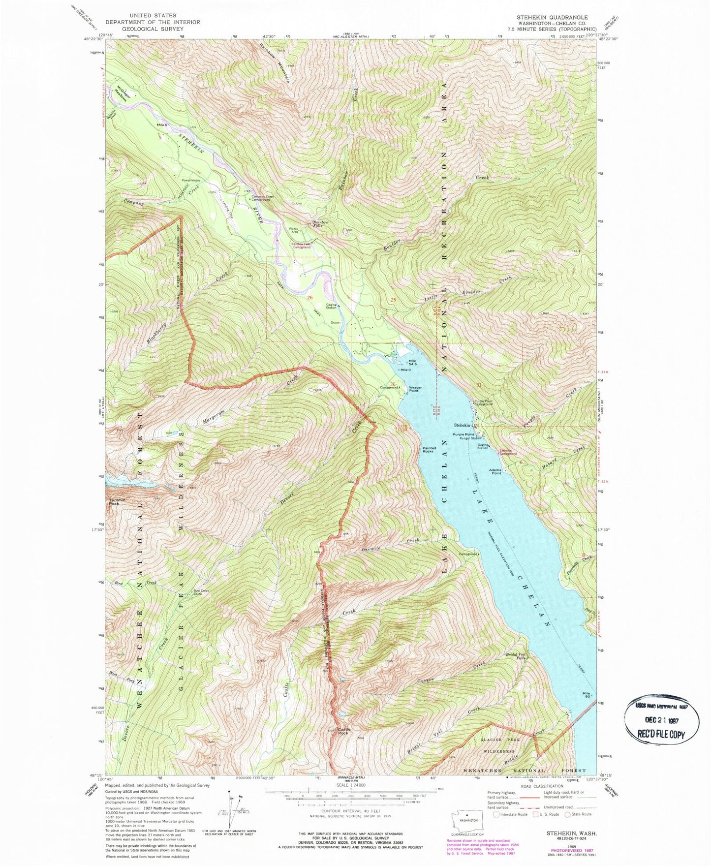
Historical USGS topographic quad map of Stehekin in the state of Washington. Typical map scale is 1:24,000, but may vary for certain years, if available. Print size: 24" x 27"
This quadrangle is in the following counties: Chelan.
The map contains contour lines, roads, rivers, towns, and lakes. Printed on high-quality waterproof paper with UV fade-resistant inks, and shipped rolled.
Contains the following named places: Adams Point, Battalion Creek, Bird Creek, Bird Creek Camp, Blackberry Creek, Boulder Creek, Bridal Veil Creek, Bridal Veil Falls, Canyon Creek, Castle Creek, Castle Rock, Company Creek, Harlequin Campground, Devore Creek, Flick Creek, Fourmile Creek, Hazard Creek, Little Boulder Creek, Margerum Creek, McGregor Meadows, Onemile Creek, Painted Rocks, Purple Creek, Purple Point, Purple Point Campground, Rainbow Creek, Rainbow Falls, Rainbow Mountain, Riddle Creek, Stehekin, Stehekin River, Weaver Point, West Fork Devore Creek, Lake Chelan National Recreation Area, Stehekin Campground, Rainbow Falls Campground, Stehekin Boat Launch, Manley Wham Campground, Weaver Point Campground, Stehekin State Airport, Stehekin Division, Golden West Visitor Center and Ranger Station, Rainbow Bridge Campsite, Rainbow Ford Campsite, Stehekin Ferry Landing