MyTopo
Classic USGS Steinerts Lake Oklahoma 7.5'x7.5' Topo Map
Regular price
$16.95
Regular price
Sale price
$16.95
Unit price
per
Couldn't load pickup availability
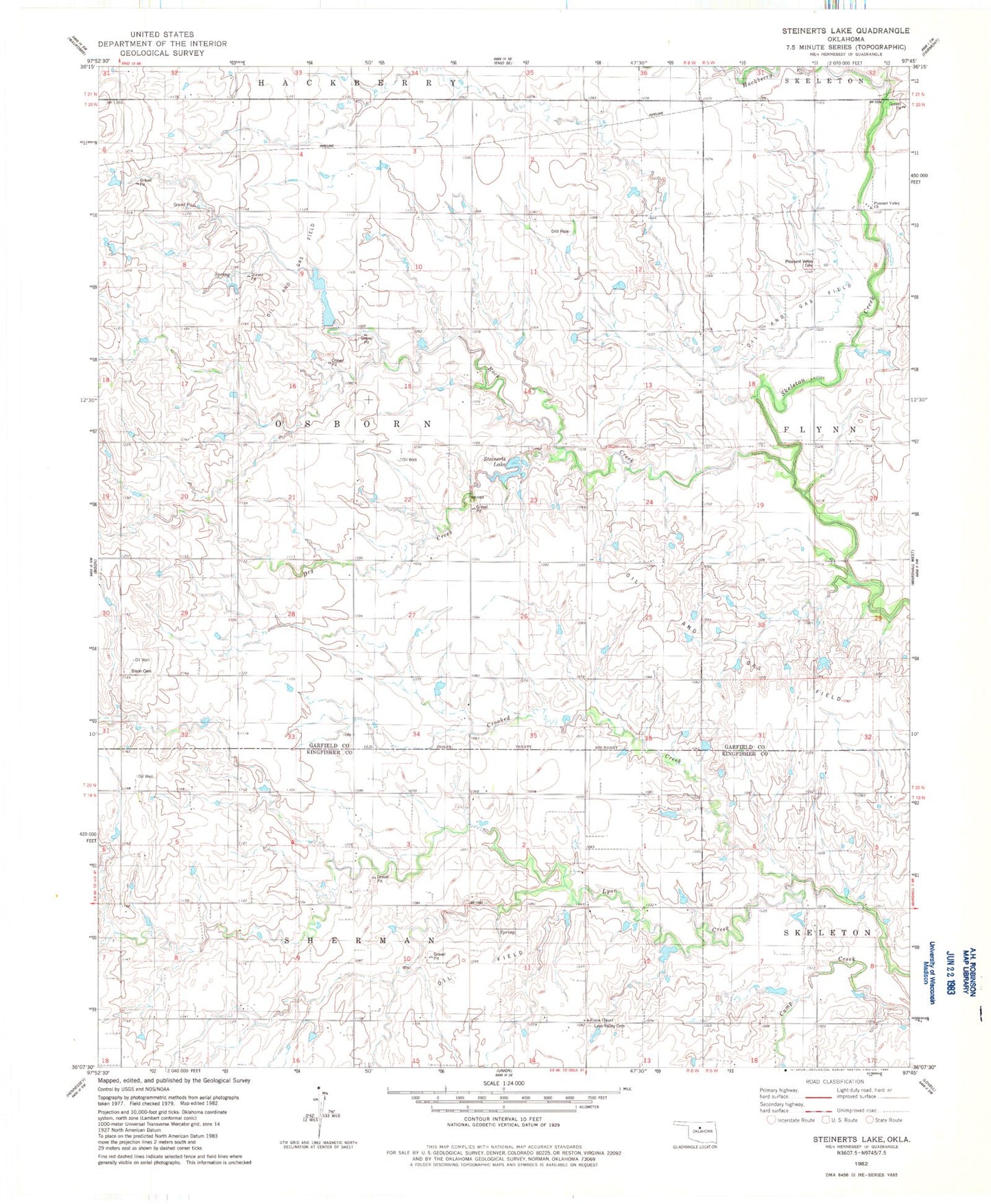
Historical USGS topographic quad map of Steinerts Lake in the state of Oklahoma. Map scale may vary for some years, but is generally around 1:24,000. Print size is approximately 24" x 27"
This quadrangle is in the following counties: Garfield, Kingfisher.
The map contains contour lines, roads, rivers, towns, and lakes. Printed on high-quality waterproof paper with UV fade-resistant inks, and shipped rolled.
Contains the following named places: 1904 Private Runway, 73720, Bison Cemetery, Crooked Creek, Dry Creek, Lyon Valley Cemetery, Lyon Valley School, Pleasant Valley Cemetery, Pleasant Valley Church, Rock Creek, Steinert Lakes Airport, Steinerts Lake, Township of Osborn, Union Chapel