MyTopo
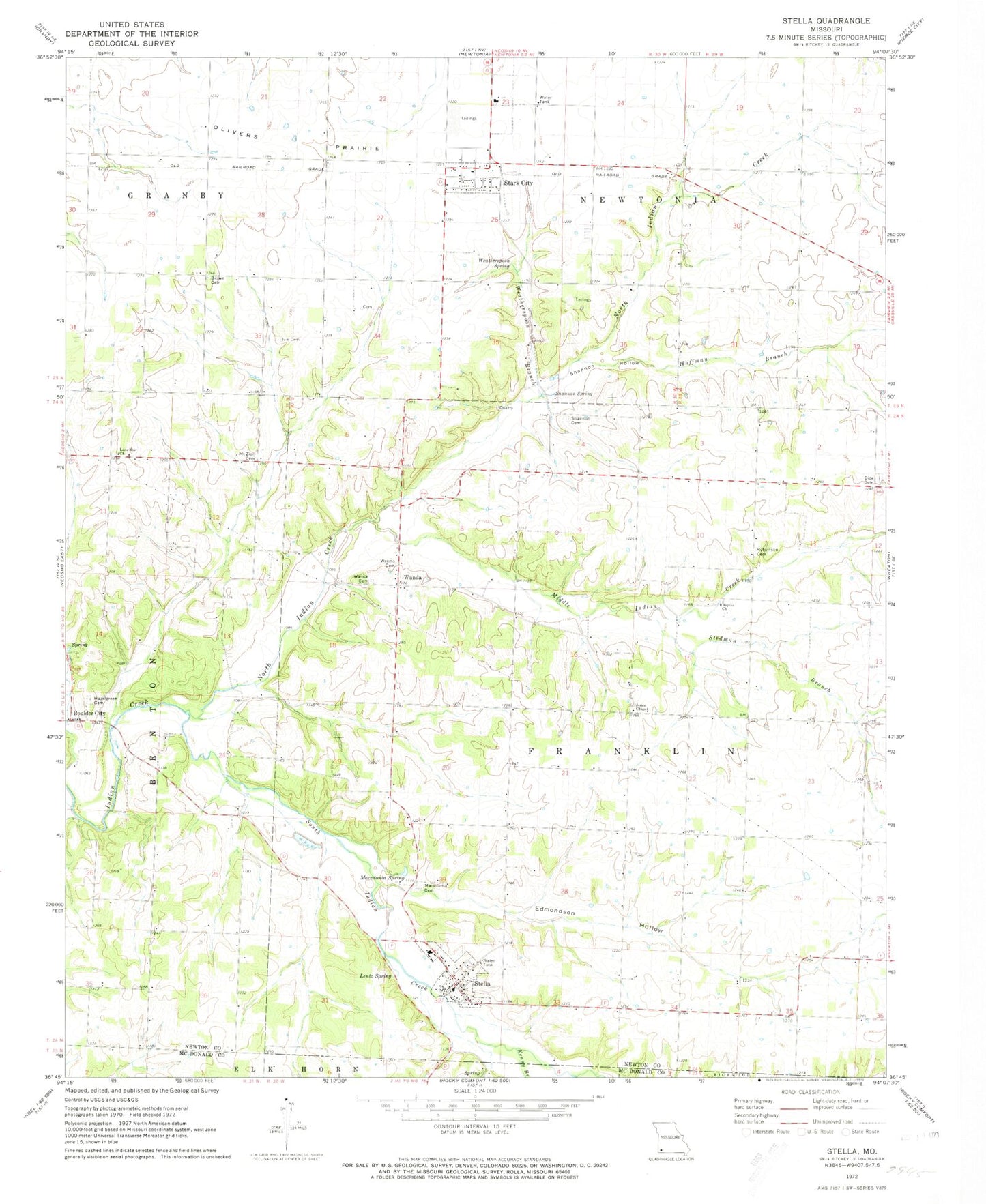
Classic USGS Stella Missouri 7.5'x7.5' Topo Map
Couldn't load pickup availability
Historical USGS topographic quad map of Stella in the state of Missouri. Map scale may vary for some years, but is generally around 1:24,000. Print size is approximately 24" x 27"
This quadrangle is in the following counties: McDonald, Newton.
The map contains contour lines, roads, rivers, towns, and lakes. Printed on high-quality waterproof paper with UV fade-resistant inks, and shipped rolled.
Contains the following named places: Boulder City, Cartmell, Chester, Dalbom Airport, Diamond Hall School, Dice Cemetery, Edmondson Hollow, Hazel Green School, Hazelgreen Cemetery, Huffman Branch, Independence School, Ivie Cemetery, Jones Chapel, Kenny Branch, Kent, Lentz Spring, Liberty School, Lone Star Church, Lone Star School, Macedonia Cemetery, Macedonia Spring, Middle Indian Creek, Midway School, Mount Zion Cemetery, North Indian Creek, Olivers Prairie, Oshkosh School, Robertson Cemetery, Shannon Cemetery, Shannon Hollow, Shannon Spring, South Indian Creek, Stark City, Stark City Post Office, Stark City Volunteer Fire Department, Stedman Branch, Stella, Stella Post Office, Stella Rural Volunteer Fire Department Station 3 Stella, Town of Stark City, Town of Stella, Township of Franklin, Township of Newtonia, Triway Elementary and Junior High School, Union School, Wadell, Wanda, Wanda Cemetery, Wanda School, Weatherspoon Branch, Weatherspoon Spring, Weems Cemetery, William M Brown Cemetery, ZIP Code: 64866