MyTopo
Classic USGS Stentz Spring Washington 7.5'x7.5' Topo Map
Couldn't load pickup availability
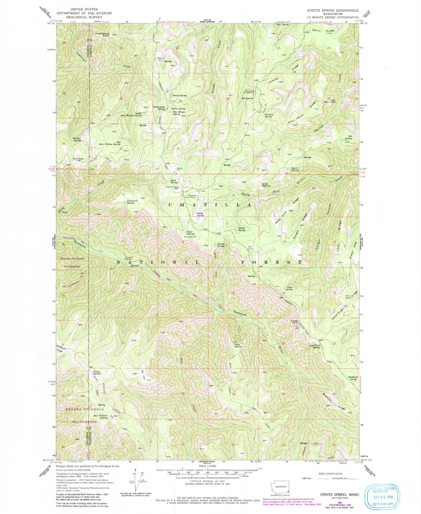
Historical USGS topographic quad map of Stentz Spring in the state of Washington. Typical map scale is 1:24,000, but may vary for certain years, if available. Print size: 24" x 27"
This quadrangle is in the following counties: Columbia, Garfield.
The map contains contour lines, roads, rivers, towns, and lakes. Printed on high-quality waterproof paper with UV fade-resistant inks, and shipped rolled.
Contains the following named places: Bear Cave Ridge, Bear Creek, Bear Creek Trail, Bear Wallow Spring, Big Bear Wallow Spring, Big Spring, Buck Spring, Buckley Ridge, Clover Spring, Cougar Canyon, Cougar Ridge, Cougar Spring, Deadhead Spring, Devils Eyebrow, Dodge Spring, Double Spring, Elk Flat, Elk Spring, Hard-to-get-to Ridge, Horse Ridge, Hunter Spring, Jelly Spring, Little Bear Wallow Spring, Lost Point Ridge, Lost Ridge, Lost Trail Spring, Panther Spring, Pole Manger Spring, Powell Camp, Ruchert Camp, Schneckloth Spring, Sheep Creek, Simpson Ridge, Spout Spring, Spruce Spring Campground, Stentz Spring, Sunflower Flat, Sweeney Spring, Tamarack Spring, Teal Spring, Unfried Ridge, Welch Ridge, Tucannon River Trail, Stentz Spring, Spruce Spring, Clearwater Guard Station, Big Spring Campground, Bear Wallow, Bear Ridge, Clearwater, Huckleberry Butte, Lost Point, Tucannon Game Reserve (historical), Powell Spring, Clearwater Lookout, Misery Spring