MyTopo
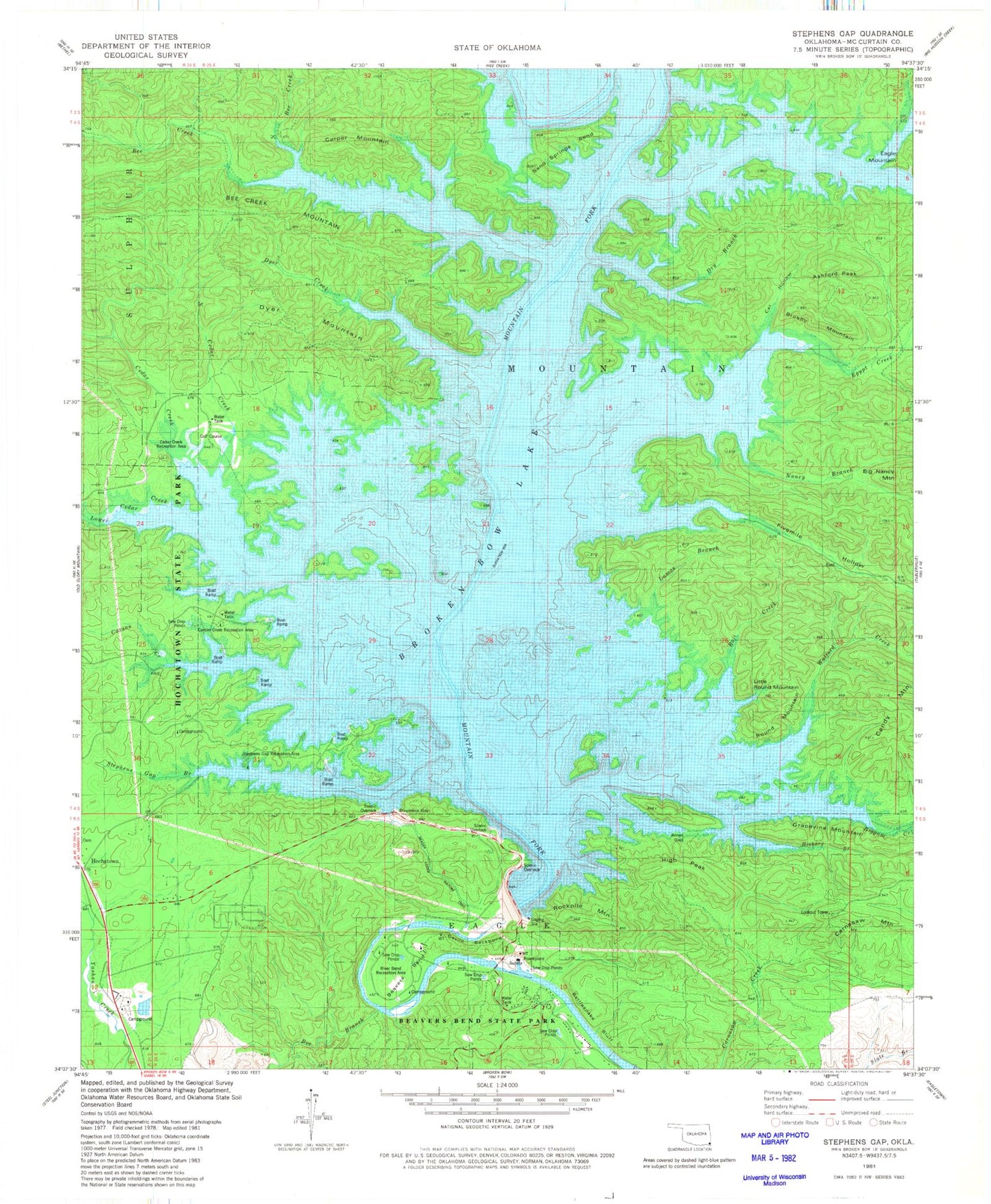
USGS Classic Stephens Gap Oklahoma 7.5'x7.5' Topo Map
Couldn't load pickup availability
Historical USGS topographic quad map of Stephens Gap in the state of Oklahoma. Scale: 1:24000. Print size: 24" x 27"
This quadrangle is in the following counties: McCurtain.
The map contains contour lines, roads, rivers, towns, lakes, and grids including latitude / longitude and UTM / MGRS. Printed on high-quality waterproof paper with UV fade-resistant inks.
Contains the following named places: Arnet Gap, Ashford Peak, Beaver Creek, Beavers Bend, Beavers Bend State Park, Bee Branch, Bee Creek, Bee Creek Mountain, Biggam Creek, Boji Creek, Brushy Mountain, Burke Branch, Calahan Lake, Carper Mountain, Carson Creek, Cat Hollow, Cedar Creek, Devils Backbone, Dyer Creek, Dyer Mountain, Dry Branch, Egypt Creek, Fivemile Hollow, Grapevine Mountain, Hickory Branch, High Peak, Lamas Branch, Little Round Mountain, Lower Cedar Creek, Nancy Branch, North Bee Creek, North Cedar Creek, Rattlesnake Bluff, Rookpile Mountain, Rough Branch, Round Mountain, Sand Springs Bend, Stephens Creek, Walford Creek, Broken Bow Lake, Candy Mountain, Carnasaw Mountain, North Otter Creek, Otter Creek, Broken Bow Dam, Rockpile Mountain, Beaver Lodge Nature Trail, Stephens Gap, River Bend Recreation Area, Stephens Gap Recreation Area, Stephens Gap Branch, Carson Creek Recreation Area, Cedar Creek Recreation Area, Hochatown State Park, County District 2, Hochatown Census Designated Place