MyTopo
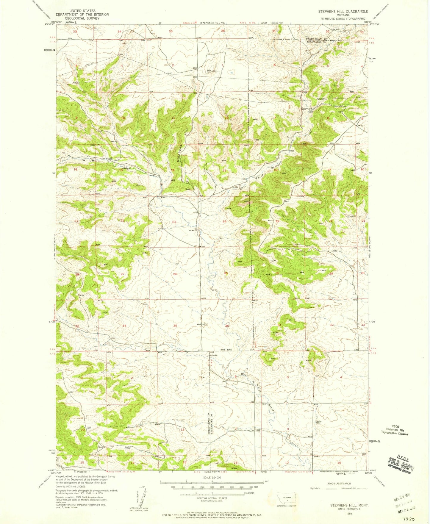
Classic USGS Stephens Hill Montana 7.5'x7.5' Topo Map
Regular price
$16.95
Regular price
Sale price
$16.95
Unit price
per
Couldn't load pickup availability
Historical USGS topographic quad map of Stephens Hill in the state of Montana. Map scale may vary for some years, but is generally around 1:24,000. Print size is approximately 24" x 27"
This quadrangle is in the following counties: Stillwater, Sweet Grass.
The map contains contour lines, roads, rivers, towns, and lakes. Printed on high-quality waterproof paper with UV fade-resistant inks, and shipped rolled.
Contains the following named places: 01N17E25C___01 Well, 01N18E33CCDC01 Well, 01S17E02ABCD01 Well, 02N18E06AACA01 Well, 59069, Stephens Hill, White Beaver Station, Wullum Gulch