MyTopo
Classic USGS Stephenson Michigan 7.5'x7.5' Topo Map
Couldn't load pickup availability
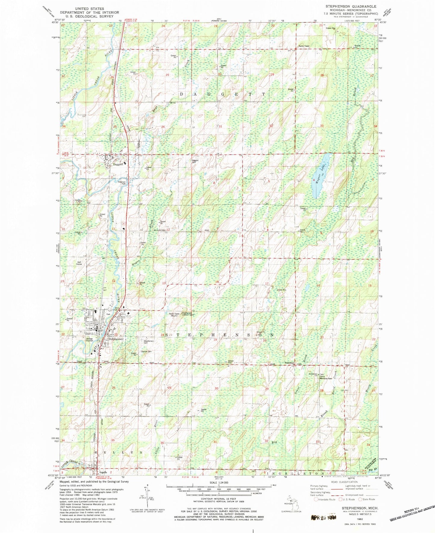
Historical USGS topographic quad map of Stephenson in the state of Michigan. Map scale may vary for some years, but is generally around 1:24,000. Print size is approximately 24" x 27"
This quadrangle is in the following counties: Menominee.
The map contains contour lines, roads, rivers, towns, and lakes. Printed on high-quality waterproof paper with UV fade-resistant inks, and shipped rolled.
Contains the following named places: Assembly of God Church, Baird Creek, Bethlehem Church, Bethlehem Covenant Cemetery, City of Stephenson, Curtis Memorial Park, Dagget Medical Clinic, Dagget Moravian Church, Dagget Station, Daggett, Daggett Cemetery, Daggett Church, Daggett Post Office, Daggett Volunteer Fire Department, Danish Cemetery, First Methodist Church, Grant Brook, Hays Creek, Hugos Brook, Indian Hills Golf Course, Ingalls, Ingalls Post Office, Ingalls Station, Menominee County Library, Michigan Department of Natural Resources Stephenson Field Office, Mid County Rescue Squad, North Stephenson Cemetery, Palestine, Peterson Park, Precious Blood Church, Ross Creek, Roubal Nursing Home, Saint Stephen Lutheran Church, Stephenson, Stephenson Cemetery, Stephenson City Hall, Stephenson Elementary School, Stephenson High School, Stephenson Lookout Tower, Stephenson Police Department, Stephenson Post Office, Stephenson Station, Stephenson Volunteer Fire Department, Township of Daggett, Township of Stephenson, Village of Daggett, Wagner Lake, ZIP Code: 49887