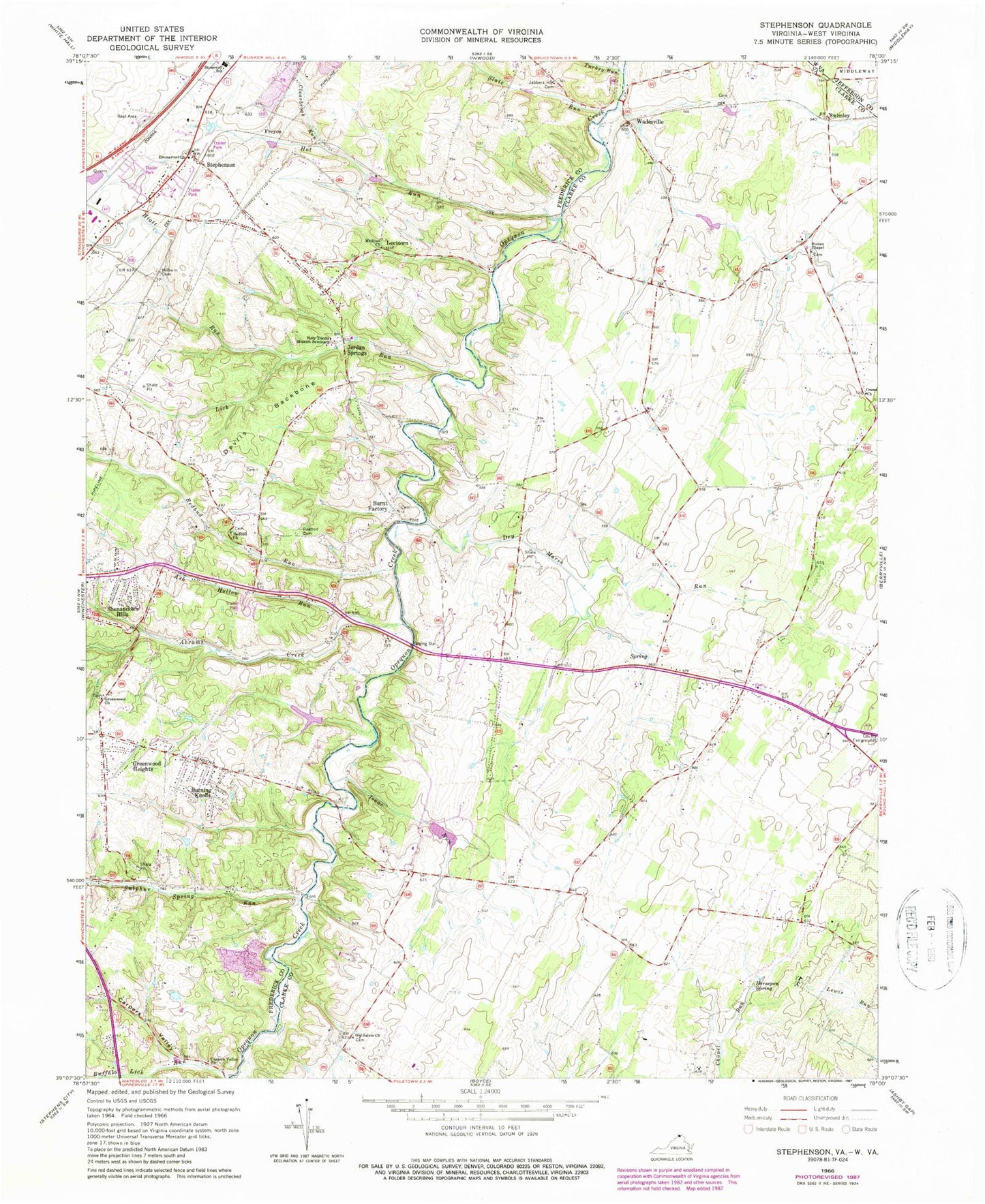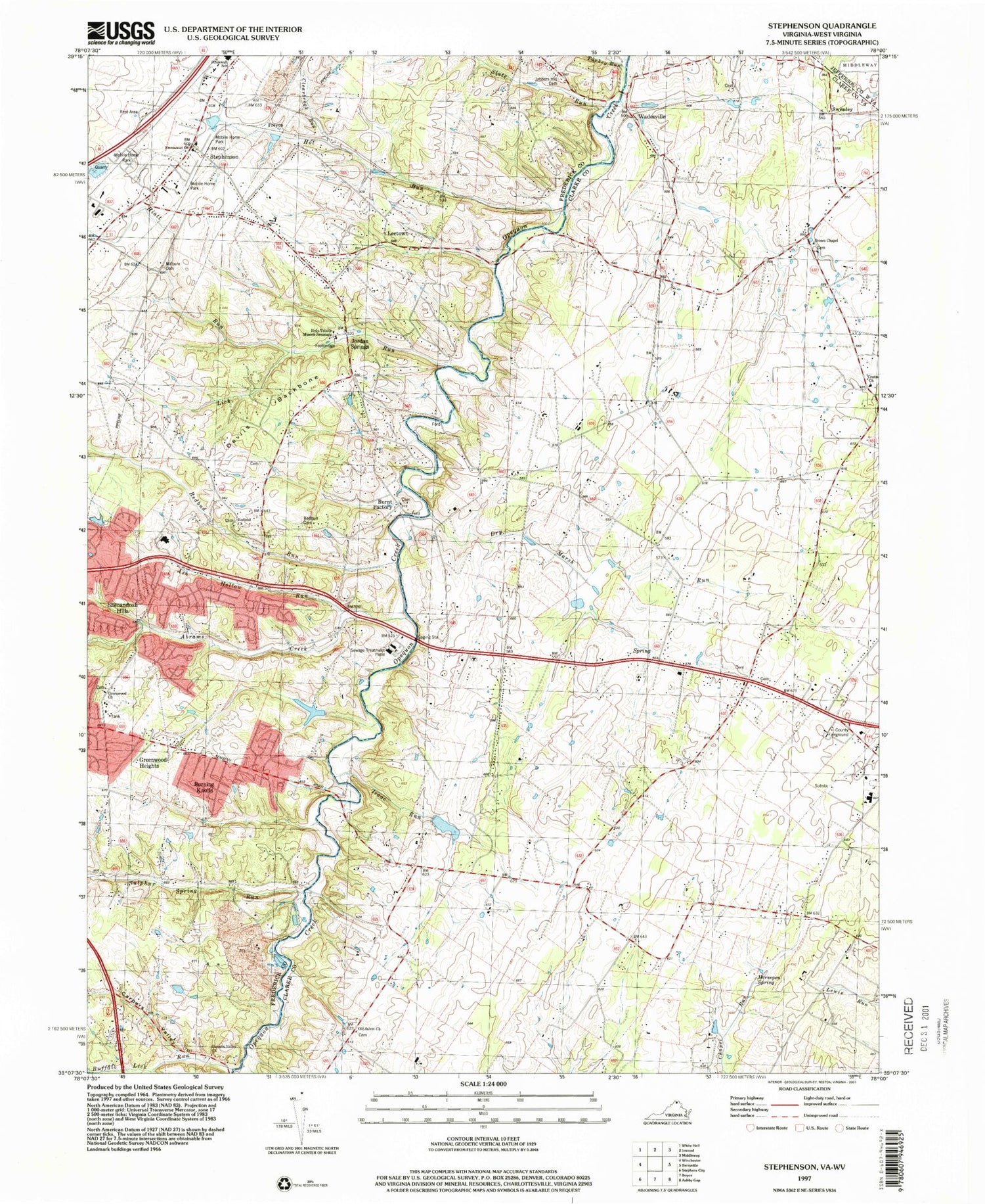

MyTopo
Classic USGS Stephenson Virginia 7.5'x7.5' Topo Map
Couldn't load pickup availability
Historical USGS topographic quad map of Stephenson in the state of Virginia. Typical map scale is 1:24,000, but may vary for certain years, if available. Print size: 24" x 27"
This quadrangle is in the following counties: Clarke, Frederick, Jefferson.
The map contains contour lines, roads, rivers, towns, and lakes. Printed on high-quality waterproof paper with UV fade-resistant inks, and shipped rolled.
Contains the following named places: Ash Hollow Run, Carpers Valley, Carpers Valley Church, Clearbrook Run, Crums Church, Devils Backbone, Dry Marsh Run, Emmanuel Church, Greenwood Church, Hiatt Run, Holy Trinity Mission Seminary, Horsepen Spring, Hot Run, Isaac Run, Jabbers Hill Cemetery, Lick Run, Milburn Cemetery, Mount Sinai Church, Old Salem Church, Redbud Cemetery, Redbud Church, Redbud Run, Slate Run, Stones Chapel, Stonewall Elementary School, Sulphur Spring Run, Turkey Run, Leetown, Swimley, Wadesville, Abrams Creek, Buffalo Lick Run, Sheppard Dam, Sheppard Pond, High View Farm Airport, Burning Knolls, Burnt Factory, Freyco, Greenwood Heights, Jordan Springs, Shenandoah Hills, Annefield Estate, Cather Estates, Clarke County Recreation Area, Crums Cemetery, Glendale School (historical), Hawthorne School (historical), Helmsley Estate, Hout School (historical), Jonesville Estate, Keeneland, Keystone Christian Academy, Keystone Estates, Minnie Wood Chapel (historical), Mount Pleasant, North End Estate, Old Salem Cemetery, Pines Corner School (historical), Rock Hall, Seventh Day Adventist School, Stones Chapel Cemetery, The Cottage Estate, Stephenson, Russell District, Stonewall District, Red Bud District, Greenwood Cemetery, Redbud Cemetery, House of Jacob, Milburn Chapel (historical), Berryville Crossing, Clevengers Ford, Rocky Ford, Seivers Ford, Sulphur Spring Ford, Tanquarys Ford, Greenwood Mills (historical), Valley Mill (historical), Blue Ridge Mobile Home Park, Brentwood Terrace, Country Park, Payne Mobile Home Park, Spring Meadows Trailer Park, Wamplers Trailer Park, Abrams Creek School (historical), Edgewood School (historical), Leetown School (historical), Red Bud School (historical), Sulfur Spring School (historical), Stephenson Post Office, Frederick County Fire and Rescue Department Station 18 - Greenwood Volunteer Fire and Rescue, Redbud Run Elementary School, Millbrook High School, Cleridge