MyTopo
Classic USGS Steprock Arkansas 7.5'x7.5' Topo Map
Couldn't load pickup availability
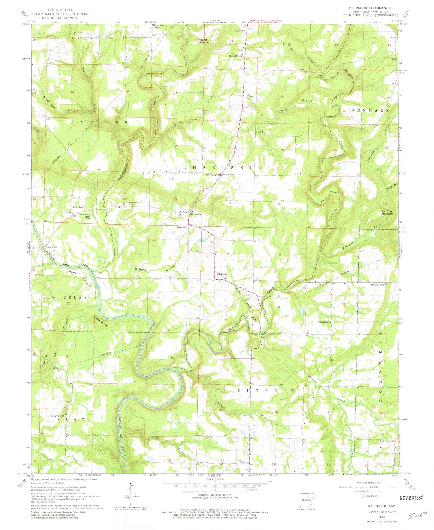
Historical USGS topographic quad map of Steprock in the state of Arkansas. Map scale may vary for some years, but is generally around 1:24,000. Print size is approximately 24" x 27"
This quadrangle is in the following counties: White.
The map contains contour lines, roads, rivers, towns, and lakes. Printed on high-quality waterproof paper with UV fade-resistant inks, and shipped rolled.
Contains the following named places: Bare Stone, Bridges Lake, Bridges Lake Dam, Cedar Branch, Chavell Lake Two, Chavell Lake Two Dam, Cypress Creek, Davenport, Dewey Bridge, Doyleville, Dripping Springs Church, Fisher Bridge, Flat Top Mountain, Fourmile Creek, Fourteenmile Creek, Friendship Church, Hill Lake, Hill Lake Dam, Holcomb Branch, Holly Grove Cemetery, Holly Springs Church, Leggett Cemetery, Little Red, Lost Branch, Maddock, March Branch, Morris Branch, Mount Olive Church, North White County Volunteer Fire Department, Onion Creek, Philadelphia Cemetery, Pine Hill, Potter Branch, Pumpkin Branch, Roosevelt Church, Round Mountain, Spring Valley Church, Steprock, Steprock Church, Steprock Post Office, Stevens Creek, Sunnydale, Tater Hill, Tenmile Creek, Township of Guthrie, Township of Hartsell, Township of Jackson, Wells Bottom, White Oak Hollow, Wildcat Hill, ZIP Code: 72081